Endangered
An application has been made to demolish or significantly alter these buildings.
If a property is deemed to have historic merit, the Town has the option of placing a stay of demolition for up to 12 months — or 18 months for National Register properties — to allow the Town and the owner to discuss alternatives to demolition of the property.
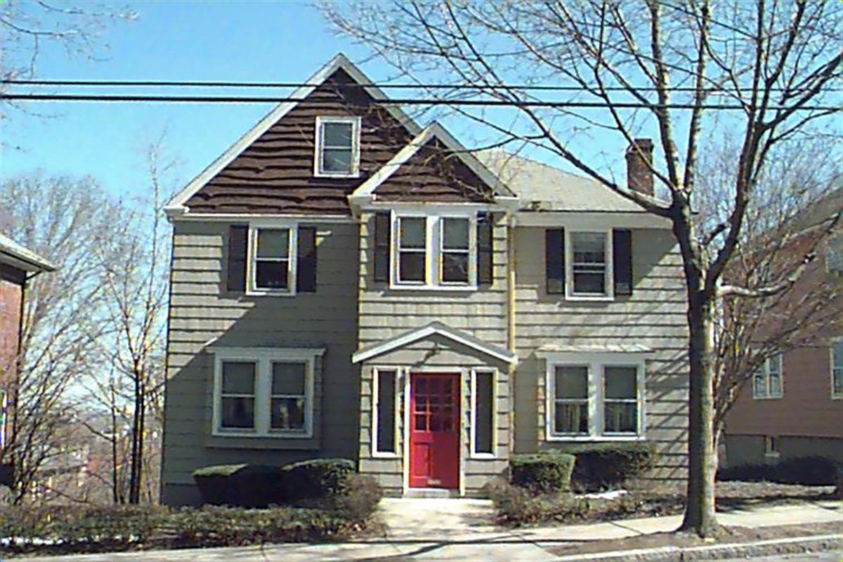
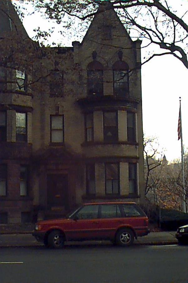
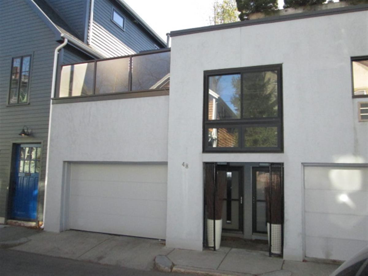
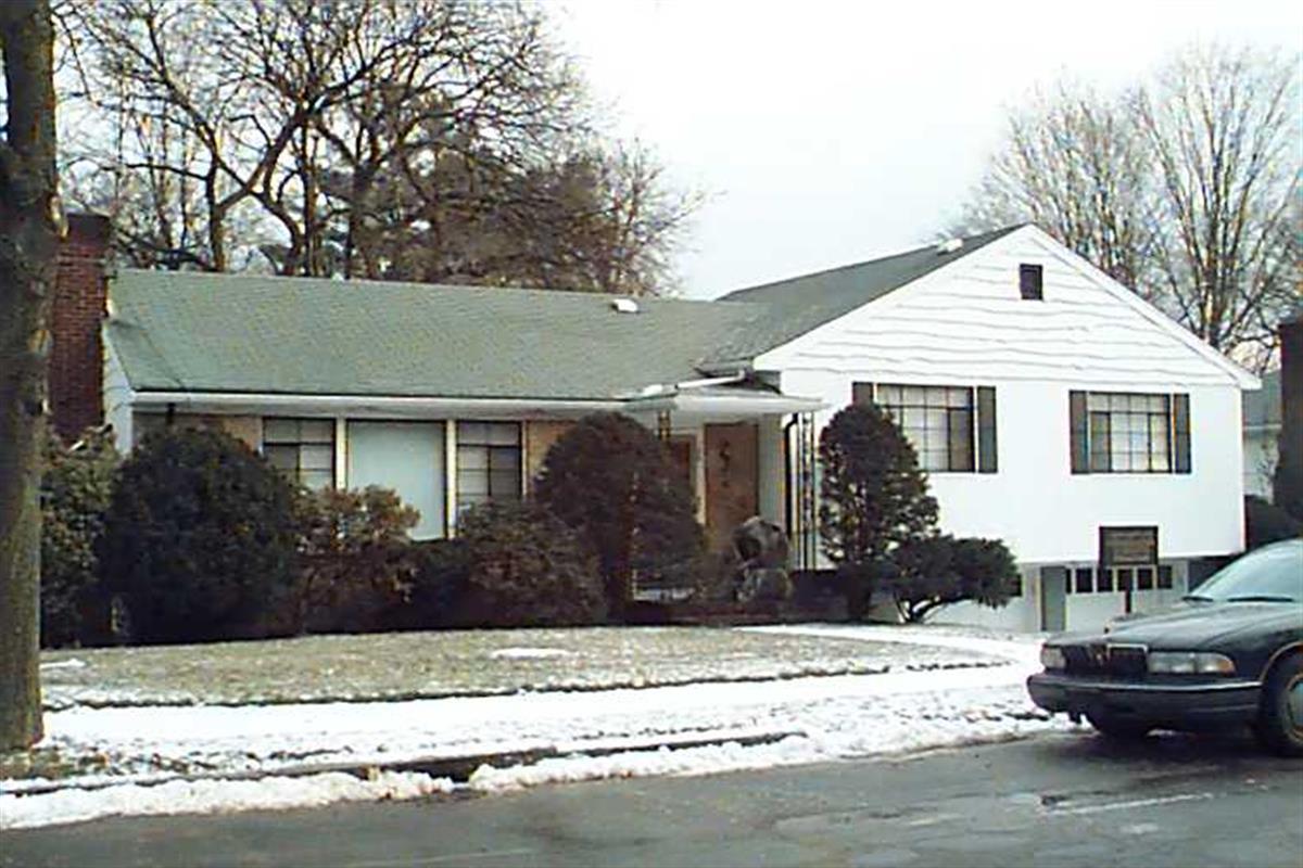
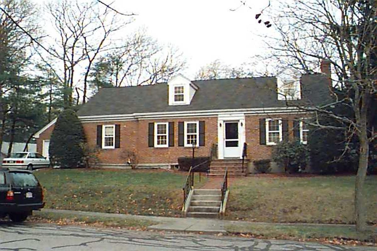
319 Mason Ter
Built:
1930Class:
Single Family HouseLand area:
5,625 sfFAR:
0.36Owner:
Lingyun JiaFY26:
$1,821,500 Δ2.77%| FY | Assessed | Change |
| 26 | $1,821,500 | 2.77% |
| 25 | $1,772,400 | 4.16% |
| 24 | $1,701,600 | 8.78% |
| 23 | $1,564,300 | 5.01% |
| 22 | $1,489,700 | 4.00% |
| 21 | $1,432,400 | 10.47% |
| 20 | $1,296,700 | 5.69% |
| 19 | $1,226,900 | 14.32% |
| 18 | $1,073,200 | 6.01% |
| 17 | $1,012,400 | 7.00% |
| 16 | $946,200 | 19.45% |
| 15 | $792,100 | 7.72% |
| 14 | $735,300 | 3.00% |
| 13 | $713,900 | 0.00% |
| 12 | $713,900 | 2.56% |
| 11 | $696,100 | 0.00% |
| 10 | $696,100 | 0.00% |
| 09 | $696,100 | 3.88% |
| 08 | $670,100 | -4.00% |
| 07 | $698,000 | 0.01% |
| 06 | $697,900 | 13.46% |
| 05 | $615,100 | 7.01% |
| 04 | $574,800 | 10.07% |
| 03 | $522,200 | 6.59% |
| 02 | $489,900 |
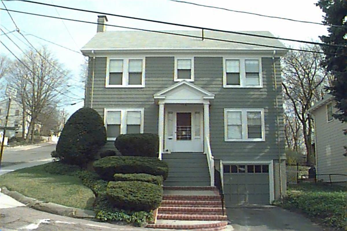
2 City View Rd
Built:
1939Class:
Single Family HouseLand area:
5,147 sfFAR:
0.30Owner:
Peninah S Rosengard TrFY26:
$1,869,000 Δ2.99%| FY | Assessed | Change |
| 26 | $1,869,000 | 2.99% |
| 25 | $1,814,700 | 4.04% |
| 24 | $1,744,200 | 10.76% |
| 23 | $1,574,800 | 5.00% |
| 22 | $1,499,800 | 4.00% |
| 21 | $1,442,100 | 10.19% |
| 20 | $1,308,700 | 5.00% |
| 19 | $1,246,400 | 14.03% |
| 18 | $1,093,000 | 5.44% |
| 17 | $1,036,600 | 7.00% |
| 16 | $968,800 | 18.84% |
| 15 | $815,200 | 5.86% |
| 14 | $770,100 | 3.02% |
| 13 | $747,500 | 0.66% |
| 12 | $742,600 | 20.85% |
| 11 | $614,500 | 1.12% |
| 10 | $607,700 | 0.00% |
| 09 | $607,700 | 9.26% |
| 08 | $556,200 | -4.00% |
| 07 | $579,400 | 0.02% |
| 06 | $579,300 | 9.24% |
| 05 | $530,300 | 7.02% |
| 04 | $495,500 | 28.67% |
| 03 | $385,100 | 0.65% |
| 02 | $382,600 |
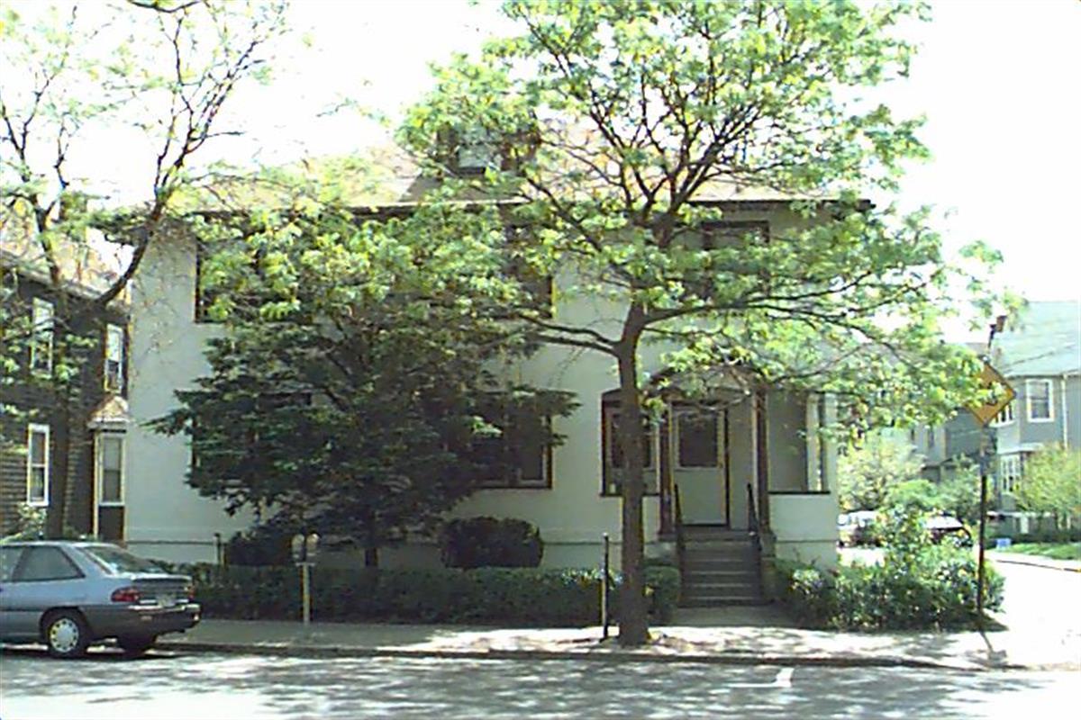
18 Cypress St
Built:
1920Class:
Two-Family HouseLand area:
2,937 sfFAR:
0.79Owner:
Dmitriy Iokhvid; Lyuba EydlinFY26:
$1,648,900 Δ0.52%| FY | Assessed | Change |
| 26 | $1,648,900 | 0.52% |
| 25 | $1,640,300 | 1.71% |
| 24 | $1,612,800 | 10.93% |
| 23 | $1,453,900 | 5.01% |
| 22 | $1,384,600 | 4.00% |
| 21 | $1,331,400 | 3.81% |
| 20 | $1,282,500 | 5.00% |
| 19 | $1,221,400 | 6.60% |
| 18 | $1,145,800 | 8.00% |
| 17 | $1,060,900 | 9.99% |
| 16 | $964,500 | 10.00% |
| 15 | $876,800 | 10.28% |
| 14 | $795,100 | 5.01% |
| 13 | $757,200 | 0.00% |
| 12 | $757,200 | -0.71% |
| 11 | $762,600 | 0.00% |
| 10 | $762,600 | 0.00% |
| 09 | $762,600 | 6.46% |
| 08 | $716,300 | -2.42% |
| 07 | $734,100 | 0.00% |
| 06 | $734,100 | 18.67% |
| 05 | $618,600 | 7.01% |
| 04 | $578,100 | 10.01% |
| 03 | $525,500 | 14.19% |
| 02 | $460,200 |
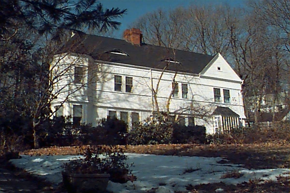
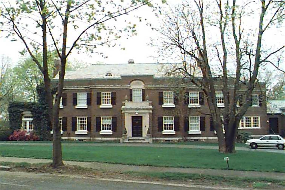
213 Gardner Rd
Built:
1888Class:
Single Family HouseLand area:
17,153 sfFAR:
0.24Owner:
Live Oak Number One IncFY26:
$3,408,200 Δ1.76%| FY | Assessed | Change |
| 26 | $3,408,200 | 1.76% |
| 25 | $3,349,400 | 2.95% |
| 24 | $3,253,500 | 12.40% |
| 23 | $2,894,500 | 5.00% |
| 22 | $2,756,700 | 4.00% |
| 21 | $2,650,600 | -7.56% |
| 20 | $2,867,500 | 5.00% |
| 19 | $2,730,900 | 9.74% |
| 18 | $2,488,600 | 6.00% |
| 17 | $2,347,700 | 8.33% |
| 16 | $2,167,100 | 7.00% |
| 15 | $2,025,300 | 5.36% |
| 14 | $1,922,200 | 3.00% |
| 13 | $1,866,200 | 0.00% |
| 12 | $1,866,200 | 0.91% |
| 11 | $1,849,300 | 1.08% |
| 10 | $1,829,500 | 1.60% |
| 09 | $1,800,700 | 14.84% |
| 08 | $1,568,000 | -3.95% |
| 07 | $1,632,400 | 0.00% |
| 06 | $1,632,400 | 6.73% |
| 05 | $1,529,500 | 12.75% |
| 04 | $1,356,600 | 11.04% |
| 03 | $1,221,700 | 25.14% |
| 02 | $976,300 |
Historic name:
Strong, William B. HouseNeighborhood:
Aspinwall HillStyle(s):
Queen Anne; Shingle StyleUse(s):
Single Family Dwelling HouseSignificance(s):
Architecture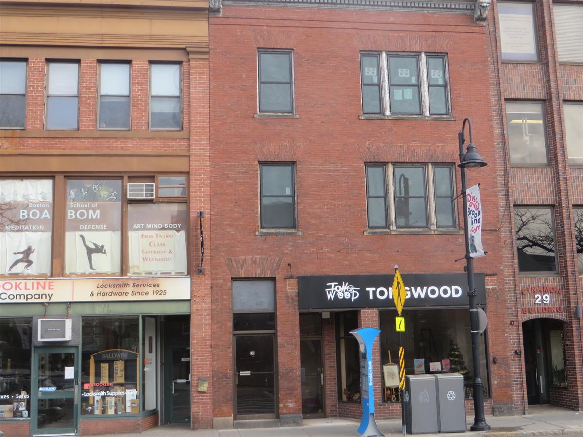
31-A Harvard St
Built:
1892Units:
2Class:
Residential with CommercialLand area:
2,846 sfFAR:
1.55Owner:
31 Harvard Street LLCFY26:
$1,972,800 Δ0.83%| FY | Assessed | Change |
| 26 | $1,972,800 | 0.83% |
| 25 | $1,956,500 | 5.23% |
| 24 | $1,859,200 | 1.96% |
| 23 | $1,823,500 | 4.48% |
| 22 | $1,745,300 | -0.30% |
| 21 | $1,750,600 | 2.09% |
| 20 | $1,714,800 | 5.29% |
| 19 | $1,628,700 | 2.02% |
| 18 | $1,596,500 | 14.02% |
| 17 | $1,400,200 | 8.07% |
| 16 | $1,295,700 | 6.99% |
| 15 | $1,211,000 | 8.87% |
| 14 | $1,112,300 | 4.92% |
| 13 | $1,060,100 | 0.19% |
| 12 | $1,058,100 | 0.75% |
| 11 | $1,050,200 | 0.86% |
| 10 | $1,041,200 | -11.18% |
| 09 | $1,172,300 | 16.91% |
| 08 | $1,002,700 | 6.85% |
| 07 | $938,400 | 1.04% |
| 06 | $928,700 | 16.09% |
| 05 | $800,000 | 9.44% |
| 04 | $731,000 | 11.43% |
| 03 | $656,000 | 18.84% |
| 02 | $552,000 |
Neighborhood:
Brookline VillageArchitect(s):
Untersee, Franz JosephStyle(s):
No styleUse(s):
Apartment House; Commercial BlockSignificance(s):
Architecture; Commerce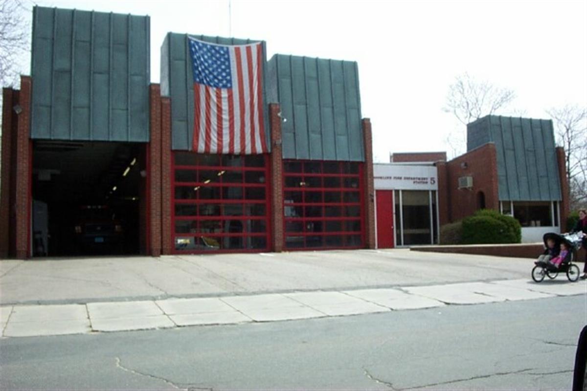
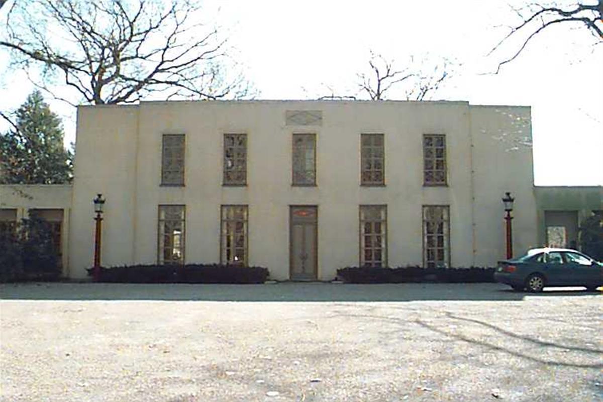
49 Babcock St
Built:
1965Class:
Municipal Public SafelyLand area:
25,935 sfFAR:
0.35Owner:
Town Of Brookline; C/O Fire Station #5FY26:
$4,852,700 Δ-2.97%| FY | Assessed | Change |
| 26 | $4,852,700 | -2.97% |
| 25 | $5,001,100 | -2.12% |
| 24 | $5,109,500 | 1.58% |
| 23 | $5,029,900 | 3.15% |
| 22 | $4,876,500 | -1.09% |
| 21 | $4,930,300 | -1.16% |
| 20 | $4,988,000 | 2.82% |
| 19 | $4,851,000 | 17.28% |
| 18 | $4,136,400 | 8.28% |
| 17 | $3,820,100 | -7.14% |
| 16 | $4,113,800 | 2.93% |
| 15 | $3,996,600 | -12.00% |
| 14 | $4,541,600 | 10.95% |
| 13 | $4,093,300 | 0.00% |
| 12 | $4,093,300 | 17.33% |
| 11 | $3,488,800 | 23.57% |
| 10 | $2,823,300 | 20.36% |
| 09 | $2,345,800 | -8.94% |
| 08 | $2,576,000 | 0.00% |
| 07 | $2,576,000 | 0.00% |
| 06 | $2,576,000 | 18.08% |
| 05 | $2,181,500 | 17.70% |
| 04 | $1,853,400 | 0.00% |
| 03 | $1,853,400 | 36.90% |
| 02 | $1,353,800 |
49 Davis Ave
Built:
1925Units:
2Class:
Residential CondominiumFY26:
$2,436,500 Δ3.50%Repeat search and uncheck condominium consolidation to view info by unit.
| FY | Assessed | Change |
| 26 | $2,436,500 | 3.50% |
| 25 | $2,354,100 | 2.00% |
| 24 | $2,308,000 | 8.49% |
| 23 | $2,127,400 | 3.00% |
| 22 | $2,065,500 | 1.00% |
| 21 | $2,045,100 | 4.39% |
| 20 | $1,959,100 | 15.15% |
| 19 | $1,701,400 | 5.00% |
| 18 | $1,620,400 | 8.01% |
| 17 | $1,500,300 | 9.99% |
| 16 | $1,364,000 | 10.01% |
| 15 | $1,239,900 | 7.74% |
| 14 | $1,150,800 | 4.99% |
| 13 | $1,096,100 | 0.00% |
| 12 | $1,096,100 | 3.51% |
| 11 | $1,058,900 | 0.00% |
| 10 | $1,058,900 | 0.00% |
| 09 | $1,058,900 | 4.29% |
| 08 | $1,015,300 | -2.92% |
| 07 | $1,045,800 | 3.00% |
| 06 | $1,015,300 |
14 Harvard St
Built:
1910Class:
Small RetailLand area:
11,104 sfFAR:
0.48Owner:
Jerome M Tuck, TrFY26:
$4,607,700 Δ2.77%| FY | Assessed | Change |
| 26 | $4,607,700 | 2.77% |
| 25 | $4,483,300 | 1.87% |
| 24 | $4,400,900 | 9.40% |
| 23 | $4,022,700 | 3.16% |
| 22 | $3,899,600 | -4.53% |
| 21 | $4,084,600 | 0.00% |
| 20 | $4,084,600 | 5.36% |
| 19 | $3,876,800 | 23.26% |
| 18 | $3,145,300 | 5.83% |
| 17 | $2,971,900 | 8.33% |
| 16 | $2,743,300 | 7.69% |
| 15 | $2,547,400 | 28.81% |
| 14 | $1,977,600 | 5.17% |
| 13 | $1,880,400 | 3.64% |
| 12 | $1,814,400 | -2.07% |
| 11 | $1,852,800 | -1.65% |
| 10 | $1,883,800 | 9.66% |
| 09 | $1,717,900 | 6.36% |
| 08 | $1,615,100 | 5.88% |
| 07 | $1,525,400 | 1.19% |
| 06 | $1,507,400 | -2.81% |
| 05 | $1,551,000 | 10.86% |
| 04 | $1,399,000 | 7.04% |
| 03 | $1,307,000 | 17.01% |
| 02 | $1,117,000 |
Neighborhood:
Brookline VillageStyle(s):
Classical RevivalUse(s):
Commercial BlockSignificance(s):
Architecture; CommerceDemolition allowed:
2025-12-09partial demolition, National Register district
1495 Beacon St
Built:
1900Units:
4Class:
Residential CondominiumFY26:
$2,842,900 Δ5.33%Repeat search and uncheck condominium consolidation to view info by unit.
| FY | Assessed | Change |
| 26 | $2,842,900 | 5.33% |
| 25 | $2,699,000 | -0.12% |
| 24 | $2,702,200 | 1.32% |
| 23 | $2,667,100 | 7.66% |
| 22 | $2,477,300 | 1.00% |
| 21 | $2,452,800 | 0.99% |
| 20 | $2,428,700 | 5.00% |
| 19 | $2,313,000 | 6.83% |
| 18 | $2,165,200 | 8.01% |
| 17 | $2,004,700 | 10.00% |
| 16 | $1,822,500 | 10.01% |
| 15 | $1,656,700 | 10.66% |
| 14 | $1,497,100 | 4.99% |
| 13 | $1,425,900 | -0.37% |
| 12 | $1,431,200 | -1.71% |
| 11 | $1,456,100 | 0.80% |
| 10 | $1,444,600 | 0.00% |
| 09 | $1,444,600 | 3.16% |
| 08 | $1,400,300 | -1.99% |
| 07 | $1,428,800 | 2.99% |
| 06 | $1,387,300 | 10.08% |
| 05 | $1,260,300 | 7.00% |
| 04 | $1,177,800 | 6.99% |
| 03 | $1,100,800 | 24.33% |
| 02 | $885,400 |
Demolition allowed:
2025-12-09storage buildings/greenhouse, National Register property
282 Newton St
Built:
c1778Units:
5Class:
Residential with AgriculturalLand area:
2,121,437 sfFAR:
0.02Owner:
Edward P Lawrence, et al TrsFY26:
$23,591,900 Δ2.09%| FY | Assessed | Change |
| 26 | $23,591,900 | 2.09% |
| 25 | $23,109,900 | 1.75% |
| 24 | $22,711,900 | 14.93% |
| 23 | $19,761,000 | 7.57% |
| 22 | $18,370,800 | 2.33% |
| 21 | $17,951,700 | 5.89% |
| 20 | $16,952,600 | 4.55% |
| 19 | $16,215,100 | 5.89% |
| 18 | $15,313,000 | 5.43% |
| 17 | $14,524,300 | 7.89% |
| 16 | $13,461,600 | 8.68% |
| 15 | $12,386,900 | 11.45% |
| 14 | $11,114,700 | 2.96% |
| 13 | $10,795,300 | 0.00% |
| 12 | $10,795,300 | 5.10% |
| 11 | $10,271,000 | 0.10% |
| 10 | $10,260,800 | 0.21% |
| 09 | $10,239,300 | -13.95% |
| 08 | $11,899,700 | -4.03% |
| 07 | $12,399,900 | 0.00% |
| 06 | $12,399,900 | 8.89% |
| 05 | $11,387,500 |
Historic name:
Harris, John House and FarmCommon name:
Allandale FarmNeighborhood:
Mount WalleyStyle(s):
FederalUse(s):
Agricultural; Single Family Dwelling HouseSignificance(s):
Agriculture; ArchitectureDesignation(s):
Nat'l Register Individual Property (10/17/1985); Nat'l Register MRA (10/17/1985)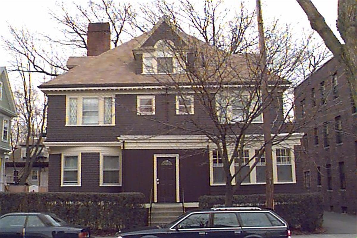
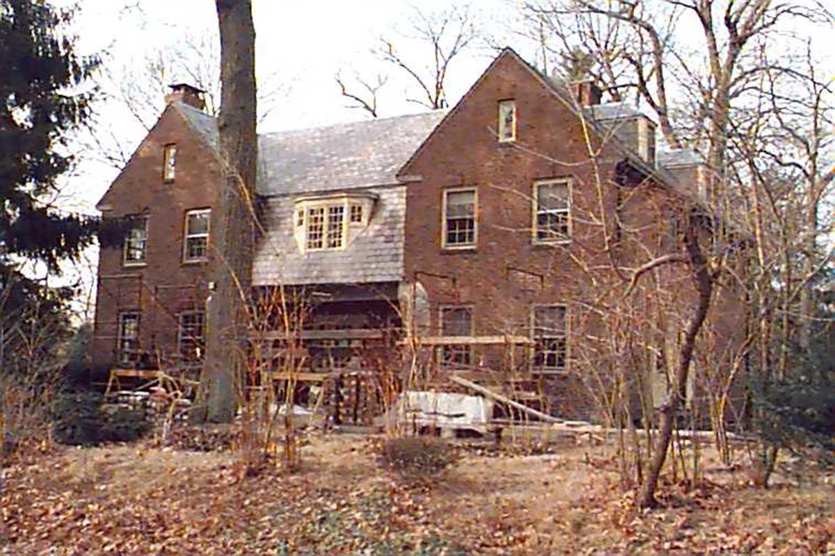
11 Naples Rd
Built:
1900Class:
Two-Family HouseLand area:
4,947 sfFAR:
0.61Owner:
Christopher Slomiak; Ming Chou & Jackson C Slomiak TrsFY26:
$1,993,900 Δ0.27%| FY | Assessed | Change |
| 26 | $1,993,900 | 0.27% |
| 25 | $1,988,600 | 1.29% |
| 24 | $1,963,200 | 1.32% |
| 23 | $1,937,600 | 5.01% |
| 22 | $1,845,200 | 4.00% |
| 21 | $1,774,300 | 3.67% |
| 20 | $1,711,500 | 5.00% |
| 19 | $1,630,000 | 11.23% |
| 18 | $1,465,400 | 7.81% |
| 17 | $1,359,200 | 10.00% |
| 16 | $1,235,600 | 10.00% |
| 15 | $1,123,300 | 15.45% |
| 14 | $973,000 | 5.00% |
| 13 | $926,700 | 0.00% |
| 12 | $926,700 | 0.76% |
| 11 | $919,700 | 0.00% |
| 10 | $919,700 | 0.00% |
| 09 | $919,700 | 2.44% |
| 08 | $897,800 | -2.00% |
| 07 | $916,100 | 0.00% |
| 06 | $916,100 | 17.75% |
| 05 | $778,000 | 7.02% |
| 04 | $727,000 | 9.98% |
| 03 | $661,000 | 11.41% |
| 02 | $593,300 |
7 Cedar Rd
Built:
1941Class:
Single Family HouseLand area:
21,053 sfFAR:
0.15Owner:
Andres D & Maria J MogollonFY26:
$2,621,900 Δ4.37%| FY | Assessed | Change |
| 26 | $2,621,900 | 4.37% |
| 25 | $2,512,100 | 3.82% |
| 24 | $2,419,700 | 11.79% |
| 23 | $2,164,600 | 5.01% |
| 22 | $2,061,400 | -5.38% |
| 21 | $2,178,500 | 5.45% |
| 20 | $2,065,900 | 5.00% |
| 19 | $1,967,500 | 1.04% |
| 18 | $1,947,300 | 6.00% |
| 17 | $1,837,100 | 10.33% |
| 16 | $1,665,100 | 10.45% |
| 15 | $1,507,600 | 2.61% |
| 14 | $1,469,200 | 4.60% |
| 13 | $1,404,600 | 0.00% |
| 12 | $1,404,600 | 7.18% |
| 11 | $1,310,500 | 12.15% |
| 10 | $1,168,500 | 1.22% |
| 09 | $1,154,400 | -9.78% |
| 08 | $1,279,600 | -4.00% |
| 07 | $1,332,900 | 0.02% |
| 06 | $1,332,700 | 7.03% |
| 05 | $1,245,200 | 7.00% |
| 04 | $1,163,700 | 9.99% |
| 03 | $1,058,000 | 17.58% |
| 02 | $899,800 |
Neighborhood:
WoodlandStyle(s):
Colonial RevivalUse(s):
Single Family Dwelling HouseSignificance(s):
ArchitectureDemolition delayed to:
2027-04-07partial demolition, National Register district
119 Hyslop Rd
Built:
1920Class:
Single Family HouseLand area:
51,748 sfFAR:
0.20Owner:
Paul B & Sandra M EdgerleyFY26:
$11,516,200 Δ-0.69%| FY | Assessed | Change |
| 26 | $11,516,200 | -0.69% |
| 25 | $11,596,200 | 2.89% |
| 24 | $11,270,000 | 13.35% |
| 23 | $9,943,000 | 5.00% |
| 22 | $9,469,600 | 4.00% |
| 21 | $9,105,400 | 3.48% |
| 20 | $8,799,600 | 5.00% |
| 19 | $8,380,600 | 3.11% |
| 18 | $8,127,600 | 6.00% |
| 17 | $7,667,400 | 7.77% |
| 16 | $7,114,600 | 7.00% |
| 15 | $6,649,200 | 2.60% |
| 14 | $6,480,900 | 3.00% |
| 13 | $6,292,100 | 0.00% |
| 12 | $6,292,100 | 4.12% |
| 11 | $6,043,300 | 0.00% |
| 10 | $6,043,300 | 0.06% |
| 09 | $6,039,600 | 3.64% |
| 08 | $5,827,500 | 0.48% |
| 07 | $5,799,600 | 0.05% |
| 06 | $5,796,500 | 22.25% |
| 05 | $4,741,700 | 7.00% |
| 04 | $4,431,500 | 11.31% |
| 03 | $3,981,400 | 35.61% |
| 02 | $2,936,000 |
Historic name:
Hammon, E. C. HouseNeighborhood:
Fisher HillArchitect(s):
Parker, Thomas and RiceStyle(s):
Colonial RevivalUse(s):
Single Family Dwelling HouseSignificance(s):
ArchitectureDesignation(s):
Nat'l Register District (10/17/1985); Nat'l Register MRA (10/17/1985)Demolition allowed:
2025-08-19partial demolition, National Register area
27 White Pl
Built:
1857Class:
Single Family HouseLand area:
2,050 sfFAR:
0.52Owner:
Melody K Morris; Jonathan M GreinerFY26:
$1,421,000 Δ3.09%| FY | Assessed | Change |
| 26 | $1,421,000 | 3.09% |
| 25 | $1,378,400 | 4.64% |
| 24 | $1,317,300 | 19.49% |
| 23 | $1,102,400 | 5.01% |
| 22 | $1,049,800 | 4.00% |
| 21 | $1,009,400 | 7.74% |
| 20 | $936,900 | 5.00% |
| 19 | $892,300 | 8.59% |
| 18 | $821,700 | 6.00% |
| 17 | $775,200 | 7.00% |
| 16 | $724,500 | 7.00% |
| 15 | $677,100 | 5.62% |
| 14 | $641,100 | 21.74% |
| 13 | $526,600 | 0.00% |
| 12 | $526,600 | 1.37% |
| 11 | $519,500 | 0.00% |
| 10 | $519,500 | 0.00% |
| 09 | $519,500 | 14.03% |
| 08 | $455,600 | -4.00% |
| 07 | $474,600 | 0.02% |
| 06 | $474,500 | 24.64% |
| 05 | $380,700 | 7.00% |
| 04 | $355,800 | 9.98% |
| 03 | $323,500 | 23.43% |
| 02 | $262,100 |
Historic name:
Libbey, J. O. HouseNeighborhood:
Brookline Village; White PlaceStyle(s):
Not researchedUse(s):
Single Family Dwelling HouseSignificance(s):
ArchitectureDesignation(s):
Nat'l Register District (10/17/1985); Nat'l Register MRA (10/17/1985)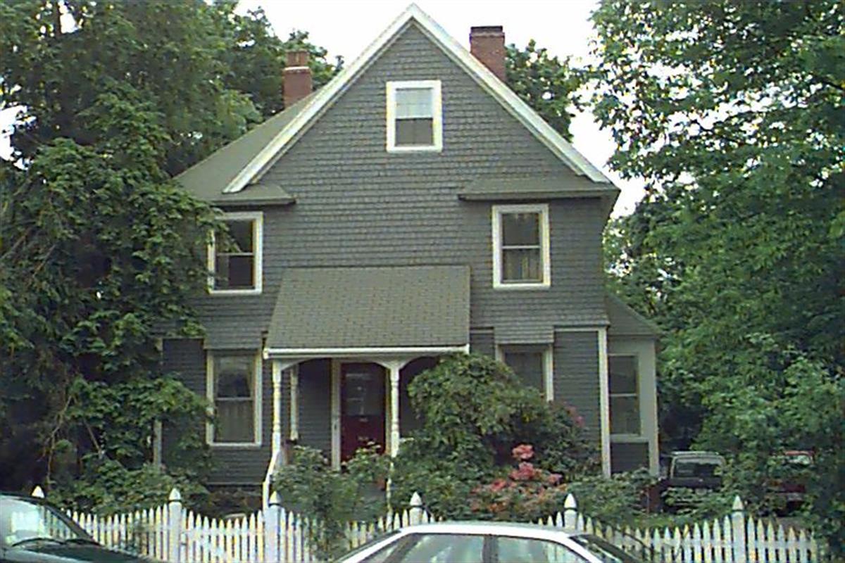
80 Greenough St
Built:
1880Class:
Single Family HouseLand area:
6,447 sfFAR:
0.41Owner:
Andreas Rolfs Trs; Dongmei ZuoFY26:
$2,218,400 Δ0.90%| FY | Assessed | Change |
| 26 | $2,218,400 | 0.90% |
| 25 | $2,198,600 | 4.01% |
| 24 | $2,113,900 | 13.85% |
| 23 | $1,856,800 | 5.00% |
| 22 | $1,768,400 | 4.01% |
| 21 | $1,700,300 | 5.73% |
| 20 | $1,608,100 | 5.00% |
| 19 | $1,531,500 | 5.46% |
| 18 | $1,452,200 | 6.99% |
| 17 | $1,357,300 | 7.00% |
| 16 | $1,268,500 | 7.00% |
| 15 | $1,185,500 | 5.76% |
| 14 | $1,120,900 | 3.00% |
| 13 | $1,088,300 | 0.00% |
| 12 | $1,088,300 | 1.10% |
| 11 | $1,076,500 | 0.00% |
| 10 | $1,076,500 | -0.33% |
| 09 | $1,080,100 | 5.13% |
| 08 | $1,027,400 | -4.24% |
| 07 | $1,072,900 | 0.90% |
| 06 | $1,063,300 | 19.34% |
| 05 | $891,000 | 7.00% |
| 04 | $832,700 | 10.00% |
| 03 | $757,000 | 13.02% |
| 02 | $669,800 |
45 Beverly Rd
Built:
1941Class:
Single Family HouseLand area:
19,200 sfFAR:
0.12Owner:
Frank Huang; Kara LingFY26:
$1,752,900 Δ8.27%| FY | Assessed | Change |
| 26 | $1,752,900 | 8.27% |
| 25 | $1,619,000 | 3.92% |
| 24 | $1,557,900 | 11.29% |
| 23 | $1,399,900 | 5.00% |
| 22 | $1,333,200 | 4.00% |
| 21 | $1,281,900 | 6.18% |
| 20 | $1,207,300 | 5.00% |
| 19 | $1,149,800 | 0.08% |
| 18 | $1,148,900 | 6.00% |
| 17 | $1,083,900 | 7.00% |
| 16 | $1,013,000 | 7.00% |
| 15 | $946,700 | 7.71% |
| 14 | $878,900 | 3.00% |
| 13 | $853,300 | 0.00% |
| 12 | $853,300 | -1.85% |
| 11 | $869,400 | 0.00% |
| 10 | $869,400 | -1.52% |
| 09 | $882,800 | 2.71% |
| 08 | $859,500 | -3.74% |
| 07 | $892,900 | -0.30% |
| 06 | $895,600 | 12.23% |
| 05 | $798,000 | 7.00% |
| 04 | $745,800 | 10.02% |
| 03 | $677,900 | 10.37% |
| 02 | $614,200 |
48-54 White Pl
Built:
c1860Units:
6Class:
Residential CondominiumFY26:
$5,035,300 Δ1.51%Repeat search and uncheck condominium consolidation to view info by unit.
| FY | Assessed | Change |
| 26 | $5,035,300 | 1.51% |
| 25 | $4,960,300 | 2.00% |
| 24 | $4,863,200 | 1.63% |
| 23 | $4,785,400 | 2.00% |
| 22 | $4,691,500 | 0.99% |
| 21 | $4,645,300 | 1.00% |
| 20 | $4,599,400 | 6.51% |
| 19 | $4,318,300 | 2.70% |
| 18 | $4,204,700 | 8.62% |
| 17 | $3,871,100 | 12.10% |
| 16 | $3,453,400 | 10.53% |
| 15 | $3,124,500 | 9.54% |
| 14 | $2,852,400 | 4.99% |
| 13 | $2,716,800 | 0.00% |
| 12 | $2,716,800 | -2.22% |
| 11 | $2,778,400 | 0.00% |
| 10 | $2,778,400 | 0.54% |
| 09 | $2,763,600 | 3.15% |
| 08 | $2,679,100 | -2.92% |
| 07 | $2,759,700 | 3.00% |
| 06 | $2,679,200 | 14.86% |
| 05 | $2,332,500 | 8.34% |
| 04 | $2,152,900 | -0.75% |
| 03 | $2,169,100 | 37.48% |
| 02 | $1,577,700 |
Historic name:
Seamans, J. M. HouseNeighborhood:
Brookline Village; White PlaceStyle(s):
Not researchedUse(s):
Single Family Dwelling HouseSignificance(s):
ArchitectureDesignation(s):
Nat'l Register District (10/17/1985); Nat'l Register MRA (10/17/1985)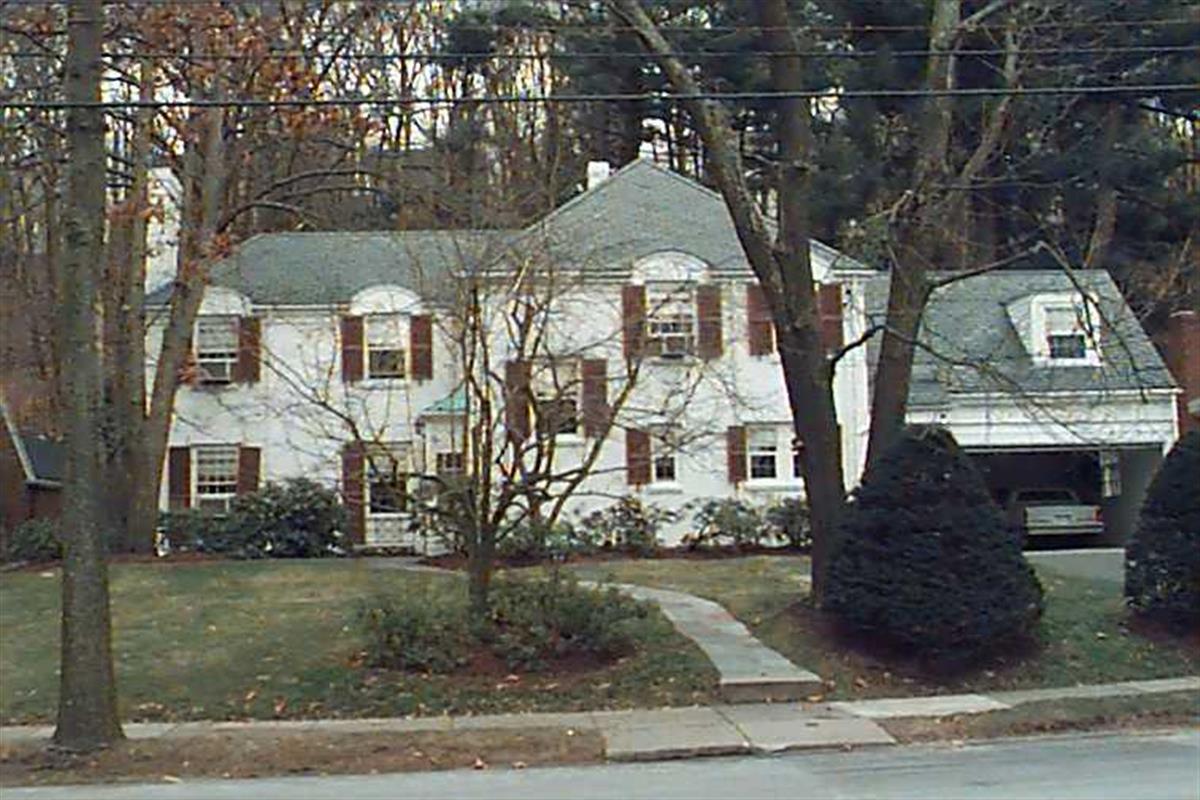
52 Beverly Rd
Built:
1935Class:
Single Family HouseLand area:
15,890 sfFAR:
0.19Owner:
Elizabeth H & Oliver C Jr Scholle TrsFY26:
$2,158,600 Δ6.63%| FY | Assessed | Change |
| 26 | $2,158,600 | 6.63% |
| 25 | $2,024,400 | 3.97% |
| 24 | $1,947,100 | 10.71% |
| 23 | $1,758,800 | 5.00% |
| 22 | $1,675,100 | 59.20% |
| 21 | $1,052,200 | -19.41% |
| 20 | $1,305,600 | 5.00% |
| 19 | $1,243,400 | 0.93% |
| 18 | $1,232,000 | 6.00% |
| 17 | $1,162,300 | 7.00% |
| 16 | $1,086,300 | 7.00% |
| 15 | $1,015,200 | 7.19% |
| 14 | $947,100 | 3.00% |
| 13 | $919,500 | 0.00% |
| 12 | $919,500 | 0.77% |
| 11 | $912,500 | 0.00% |
| 10 | $912,500 | 0.00% |
| 09 | $912,500 | -1.18% |
| 08 | $923,400 | -4.35% |
| 07 | $965,400 | -0.01% |
| 06 | $965,500 | 9.98% |
| 05 | $877,900 | 7.00% |
| 04 | $820,500 | 10.00% |
| 03 | $745,900 | 7.79% |
| 02 | $692,000 |
25 Fisher Ave
Built:
1950Class:
Single Family HouseLand area:
41,289 sfFAR:
0.10Owner:
John M Keough; Andrea DowFY26:
$5,048,400 Δ6.08%| FY | Assessed | Change |
| 26 | $5,048,400 | 6.08% |
| 25 | $4,758,900 | 4.08% |
| 24 | $4,572,300 | 24.05% |
| 23 | $3,686,000 | 5.00% |
| 22 | $3,510,400 | 4.00% |
| 21 | $3,375,400 | 7.35% |
| 20 | $3,144,300 | 5.00% |
| 19 | $2,994,600 | -4.71% |
| 18 | $3,142,500 | 6.59% |
| 17 | $2,948,100 | 7.00% |
| 16 | $2,755,300 | 7.00% |
| 15 | $2,575,000 | 11.14% |
| 14 | $2,316,800 | 3.00% |
| 13 | $2,249,300 | 0.00% |
| 12 | $2,249,300 | 6.65% |
| 11 | $2,109,100 | 0.00% |
| 10 | $2,109,100 | 0.20% |
| 09 | $2,104,900 | 2.40% |
| 08 | $2,055,600 | -5.52% |
| 07 | $2,175,600 | 0.01% |
| 06 | $2,175,400 | 13.41% |
| 05 | $1,918,200 |
Historic name:
Price, Daniel E. HouseNeighborhood:
Fisher HillArchitect(s):
Wills, Royal BarryStyle(s):
Postwar TraditionalUse(s):
Single Family Dwelling HouseSignificance(s):
ArchitectureDesignation(s):
Nat'l Register District (10/17/1985); Nat'l Register MRA (10/17/1985)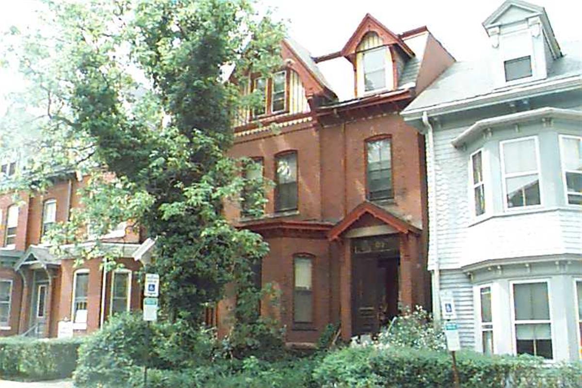
129 Walnut St
Built:
c1879Class:
Single Family HouseLand area:
2,011 sfFAR:
1.41Owner:
129 Walnut Street LLCFY26:
$892,500 Δ8.74%| FY | Assessed | Change |
| 26 | $892,500 | 8.74% |
| 25 | $820,800 | 4.27% |
| 24 | $787,200 | 12.23% |
| 23 | $701,400 | 5.00% |
| 22 | $668,000 | 4.00% |
| 21 | $642,300 | 8.72% |
| 20 | $590,800 | 4.99% |
| 19 | $562,700 | 16.14% |
| 18 | $484,500 | 6.02% |
| 17 | $457,000 | 7.00% |
| 16 | $427,100 | 6.99% |
| 15 | $399,200 | -2.20% |
| 14 | $408,200 | 3.00% |
| 13 | $396,300 | 0.00% |
| 12 | $396,300 | 3.18% |
| 11 | $384,100 | 0.00% |
| 10 | $384,100 | -0.08% |
| 09 | $384,400 | -7.93% |
| 08 | $417,500 | -4.00% |
| 07 | $434,900 | 0.00% |
| 06 | $434,900 | -4.75% |
| 05 | $456,600 | 6.98% |
| 04 | $426,800 | 11.64% |
| 03 | $382,300 | -19.57% |
| 02 | $475,300 |
Neighborhood:
Pill HillStyle(s):
Not researchedUse(s):
Multiple Family Dwelling HouseSignificance(s):
ArchitectureDesignation(s):
Local Historic District (9/6/1983)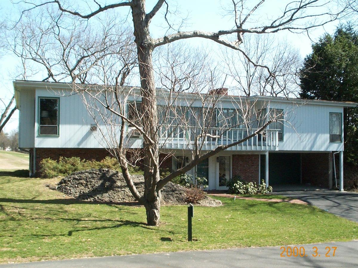
43 Fairgreen Pl
Built:
1962Class:
Single Family HouseLand area:
21,184 sfFAR:
0.10Owner:
Aces Development LLCFY26:
$2,126,900 Δ5.74%| FY | Assessed | Change |
| 26 | $2,126,900 | 5.74% |
| 25 | $2,011,400 | 4.11% |
| 24 | $1,932,000 | 13.79% |
| 23 | $1,697,800 | 5.01% |
| 22 | $1,616,800 | 3.99% |
| 21 | $1,554,700 | 6.90% |
| 20 | $1,454,400 | 5.00% |
| 19 | $1,385,200 | -4.35% |
| 18 | $1,448,200 | 6.00% |
| 17 | $1,366,200 | 7.00% |
| 16 | $1,276,800 | 7.00% |
| 15 | $1,193,300 | 9.50% |
| 14 | $1,089,800 | 3.00% |
| 13 | $1,058,100 | 0.00% |
| 12 | $1,058,100 | 1.40% |
| 11 | $1,043,500 | -0.49% |
| 10 | $1,048,600 | 0.41% |
| 09 | $1,044,300 | -1.38% |
| 08 | $1,058,900 | -4.00% |
| 07 | $1,103,000 | -0.03% |
| 06 | $1,103,300 | 4.35% |
| 05 | $1,057,300 | 7.00% |
| 04 | $988,100 | 10.00% |
| 03 | $898,300 | 23.58% |
| 02 | $726,900 |
Demolition allowed:
2025-01-14partial demolition, National Register district
1020-A Beacon St
Built:
1940Class:
Small RetailLand area:
4,050 sfFAR:
0.41Owner:
Sean D Galvin, Tr; C/O 1020-1024 Beacon St RealtyFY26:
$1,577,800 Δ0.42%| FY | Assessed | Change |
| 26 | $1,577,800 | 0.42% |
| 25 | $1,571,200 | 2.05% |
| 24 | $1,539,600 | 0.00% |
| 23 | $1,539,600 | 0.00% |
| 22 | $1,539,600 | 0.00% |
| 21 | $1,539,600 | 0.00% |
| 20 | $1,539,600 | 7.49% |
| 19 | $1,432,300 | 15.65% |
| 18 | $1,238,500 | 14.28% |
| 17 | $1,083,700 | 6.06% |
| 16 | $1,021,800 | 10.00% |
| 15 | $928,900 | 31.46% |
| 14 | $706,600 | 7.14% |
| 13 | $659,500 | -2.66% |
| 12 | $677,500 | 7.05% |
| 11 | $632,900 | -1.65% |
| 10 | $643,500 | 0.81% |
| 09 | $638,300 | -0.33% |
| 08 | $640,400 | 5.87% |
| 07 | $604,900 | -2.59% |
| 06 | $621,000 | 50.36% |
| 05 | $413,000 | 11.02% |
| 04 | $372,000 | 6.90% |
| 03 | $348,000 | 0.29% |
| 02 | $347,000 |
Historic name:
Goodman, I. H. BuildingNeighborhood:
Saint Mary's Street; Beacon StreetArchitect(s):
Moffie, Saul E.Style(s):
Not researchedUse(s):
UndeterminedSignificance(s):
ArchitectureDesignation(s):
Nat'l Register District (10/17/1985); Nat'l Register MRA (10/17/1985)Demolition allowed:
2025-01-14partial demolition, National Register district
1022 Beacon St
Built:
1920Class:
Small RetailLand area:
7,726 sfFAR:
0.30Owner:
Sean D Galvin, Tr; C/O 1020-1024 Beacon St RealtyFY26:
$2,213,700 Δ1.33%| FY | Assessed | Change |
| 26 | $2,213,700 | 1.33% |
| 25 | $2,184,600 | 2.14% |
| 24 | $2,138,900 | 0.00% |
| 23 | $2,138,900 | 0.00% |
| 22 | $2,138,900 | 0.00% |
| 21 | $2,138,900 | 0.00% |
| 20 | $2,138,900 | 5.14% |
| 19 | $2,034,300 | 13.79% |
| 18 | $1,787,700 | 7.00% |
| 17 | $1,670,800 | 7.01% |
| 16 | $1,561,300 | 6.01% |
| 15 | $1,472,800 | 18.76% |
| 14 | $1,240,200 | 5.16% |
| 13 | $1,179,300 | -2.44% |
| 12 | $1,208,800 | -6.79% |
| 11 | $1,296,900 | -1.65% |
| 10 | $1,318,600 | -5.12% |
| 09 | $1,389,800 | 4.34% |
| 08 | $1,332,000 | 5.88% |
| 07 | $1,258,000 | 1.19% |
| 06 | $1,243,200 | 0.83% |
| 05 | $1,233,000 | 10.88% |
| 04 | $1,112,000 | 7.13% |
| 03 | $1,038,000 | 0.19% |
| 02 | $1,036,000 |
Historic name:
Rotman and Babbitt BuildingNeighborhood:
Saint Mary's Street; Beacon StreetArchitect(s):
Norcross, Frederick A.Style(s):
Not researchedUse(s):
UndeterminedSignificance(s):
ArchitectureDesignation(s):
Nat'l Register District (10/17/1985); Nat'l Register MRA (10/17/1985)Demolition delayed to:
2026-06-10partial demolition, National Register district
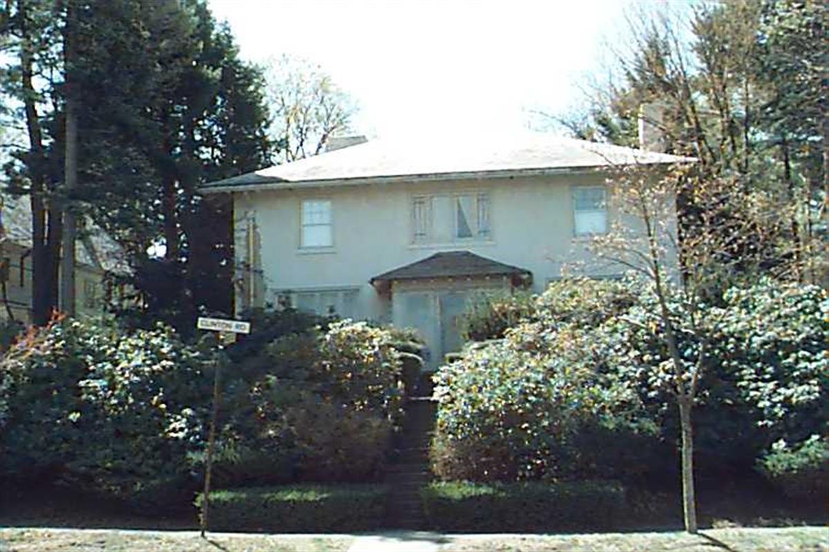
278 Clinton Rd
Built:
1911Class:
Single Family HouseLand area:
12,970 sfFAR:
0.33Owner:
278 Clinton Road LLCFY26:
$2,695,200 Δ-0.31%| FY | Assessed | Change |
| 26 | $2,695,200 | -0.31% |
| 25 | $2,703,700 | 3.94% |
| 24 | $2,601,200 | 17.06% |
| 23 | $2,222,200 | 5.00% |
| 22 | $2,116,300 | 4.00% |
| 21 | $2,034,900 | 5.46% |
| 20 | $1,929,600 | 5.00% |
| 19 | $1,837,700 | 0.32% |
| 18 | $1,831,800 | -7.65% |
| 17 | $1,983,500 | 7.00% |
| 16 | $1,853,800 | 7.00% |
| 15 | $1,732,500 | 5.42% |
| 14 | $1,643,500 | 3.00% |
| 13 | $1,595,600 | 0.00% |
| 12 | $1,595,600 | 3.58% |
| 11 | $1,540,500 | 0.00% |
| 10 | $1,540,500 | 0.12% |
| 09 | $1,538,600 | -1.11% |
| 08 | $1,555,900 | -4.00% |
| 07 | $1,620,700 | 0.01% |
| 06 | $1,620,600 | 11.23% |
| 05 | $1,457,000 | 7.00% |
| 04 | $1,361,700 | 10.00% |
| 03 | $1,237,900 | 23.41% |
| 02 | $1,003,100 |
Historic name:
Wilson HouseNeighborhood:
Fisher HillArchitect(s):
Low, Frederic F.Style(s):
Not researchedUse(s):
Single Family Dwelling HouseSignificance(s):
ArchitectureDesignation(s):
Nat'l Register District (10/17/1985); Nat'l Register MRA (10/17/1985)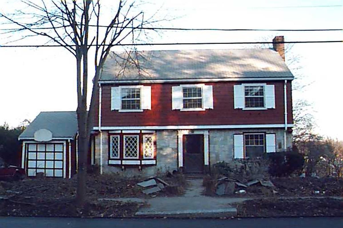
29 Goodnough Rd
Built:
2025Class:
Single Family HouseLand area:
7,572 sfFAR:
0.40Owner:
Alexa F SheinkopfFY26:
$1,007,000 Δ7.08%| FY | Assessed | Change |
| 26 | $1,007,000 | 7.08% |
| 25 | $940,400 | 4.00% |
| 24 | $904,200 | 16.75% |
| 23 | $774,500 | 5.00% |
| 22 | $737,600 | 4.00% |
| 21 | $709,200 | 7.21% |
| 20 | $661,500 | 5.00% |
| 19 | $630,000 | -0.94% |
| 18 | $636,000 | 6.00% |
| 17 | $600,000 | 6.99% |
| 16 | $560,800 | 7.00% |
| 15 | $524,100 | 1.51% |
| 14 | $516,300 | 2.99% |
| 13 | $501,300 | 0.00% |
| 12 | $501,300 | 3.83% |
| 11 | $482,800 | 0.00% |
| 10 | $482,800 | 0.00% |
| 09 | $482,800 | 1.39% |
| 08 | $476,200 | -3.99% |
| 07 | $496,000 | 0.00% |
| 06 | $496,000 | 7.66% |
| 05 | $460,700 | 6.99% |
| 04 | $430,600 | 10.02% |
| 03 | $391,400 | -2.15% |
| 02 | $400,000 |
70 Beaconsfield Rd
Built:
1917Class:
Two-Family HouseLand area:
8,726 sfFAR:
0.39Owner:
Charu & Lakshmana SwamyFY26:
$2,584,000 Δ-0.28%| FY | Assessed | Change |
| 26 | $2,584,000 | -0.28% |
| 25 | $2,591,300 | 0.42% |
| 24 | $2,580,500 | 8.84% |
| 23 | $2,371,000 | 5.00% |
| 22 | $2,258,100 | 4.00% |
| 21 | $2,171,200 | 1.75% |
| 20 | $2,133,800 | 5.00% |
| 19 | $2,032,200 | 18.80% |
| 18 | $1,710,600 | 7.99% |
| 17 | $1,584,000 | 10.00% |
| 16 | $1,440,000 | 13.95% |
| 15 | $1,263,700 | 5.64% |
| 14 | $1,196,200 | 5.00% |
| 13 | $1,139,200 | 0.00% |
| 12 | $1,139,200 | -0.54% |
| 11 | $1,145,400 | 0.00% |
| 10 | $1,145,400 | -0.01% |
| 09 | $1,145,500 | 4.57% |
| 08 | $1,095,400 | -2.00% |
| 07 | $1,117,800 | -0.92% |
| 06 | $1,128,200 | 3.92% |
| 05 | $1,085,600 | 7.00% |
| 04 | $1,014,600 | 10.00% |
| 03 | $922,400 | 40.25% |
| 02 | $657,700 |

102 Dean Rd
Built:
1907Class:
Single Family HouseLand area:
16,656 sfFAR:
0.35Owner:
Mikhail KutuzovFY26:
$5,198,700 Δ1.58%| FY | Assessed | Change |
| 26 | $5,198,700 | 1.58% |
| 25 | $5,117,900 | 3.67% |
| 24 | $4,936,500 | 190.66% |
| 23 | $1,698,400 | 5.01% |
| 22 | $1,617,400 | 4.00% |
| 21 | $1,555,200 | 7.30% |
| 20 | $1,449,400 | 5.00% |
| 19 | $1,380,400 | 0.78% |
| 18 | $1,369,700 | 6.10% |
| 17 | $1,291,000 | 7.00% |
| 16 | $1,206,500 | 7.00% |
| 15 | $1,127,600 | 2.65% |
| 14 | $1,098,500 | 3.00% |
| 13 | $1,066,500 | 0.00% |
| 12 | $1,066,500 | 6.34% |
| 11 | $1,002,900 | 0.00% |
| 10 | $1,002,900 | 0.20% |
| 09 | $1,000,900 | -17.84% |
| 08 | $1,218,200 | -4.00% |
| 07 | $1,269,000 | 0.00% |
| 06 | $1,269,000 | 6.48% |
| 05 | $1,191,800 | 7.00% |
| 04 | $1,113,800 | 9.99% |
| 03 | $1,012,600 | 16.31% |
| 02 | $870,600 |
Historic name:
Stewart, Ralph HouseNeighborhood:
Fisher HillArchitect(s):
Kilham and Hopkins; Kilham, Hopkins and Greeley; Mowell, GregoryStyle(s):
Colonial RevivalUse(s):
Single Family Dwelling HouseSignificance(s):
ArchitectureDesignation(s):
Nat'l Register District (10/17/1985); Nat'l Register MRA (10/17/1985)
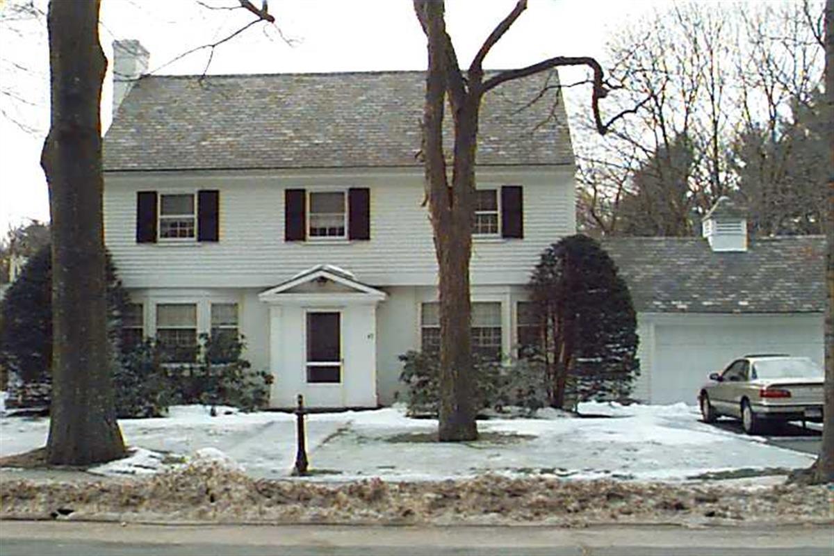
194 Lancaster Ter
Built:
1941Class:
Single Family HouseLand area:
7,585 sfFAR:
0.21Owner:
Akbar Ansari; Syeda AmeernazFY26:
$2,007,700 Δ2.46%| FY | Assessed | Change |
| 26 | $2,007,700 | 2.46% |
| 25 | $1,959,500 | 4.04% |
| 24 | $1,883,500 | 10.70% |
| 23 | $1,701,400 | 4.99% |
| 22 | $1,620,500 | 4.00% |
| 21 | $1,558,100 | 10.19% |
| 20 | $1,414,000 | 5.00% |
| 19 | $1,346,700 | 11.95% |
| 18 | $1,202,900 | 6.00% |
| 17 | $1,134,800 | 7.00% |
| 16 | $1,060,600 | 19.10% |
| 15 | $890,500 | 6.08% |
| 14 | $839,500 | 3.01% |
| 13 | $815,000 | 0.00% |
| 12 | $815,000 | 2.36% |
| 11 | $796,200 | 0.00% |
| 10 | $796,200 | 0.00% |
| 09 | $796,200 | 5.82% |
| 08 | $752,400 | -2.72% |
| 07 | $773,400 | -0.04% |
| 06 | $773,700 | 14.03% |
| 05 | $678,500 | 7.02% |
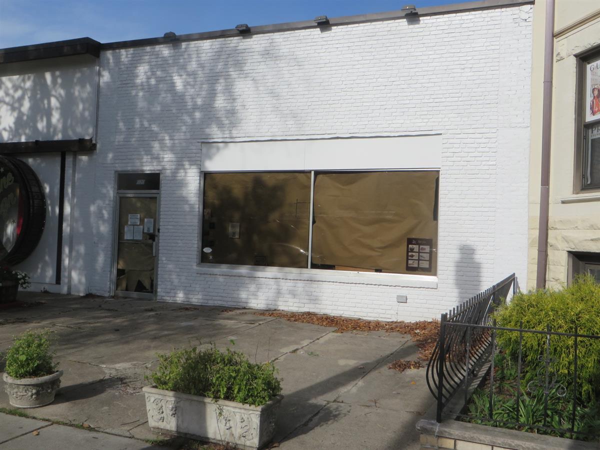
| 04 | $634,000 | 12.43% |
| 03 | $563,900 | 10.29% |
| 02 | $511,300 |
Historic name:
Orlando, John - Romanov, Dr. David HouseNeighborhood:
Corey HillArchitect(s):
Orlando, FrankStyle(s):
No styleUse(s):
Single Family Dwelling HouseSignificance(s):
Architecture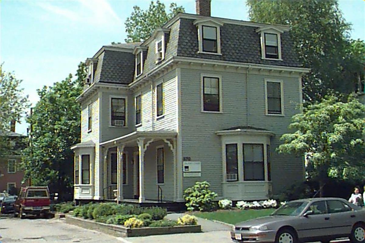
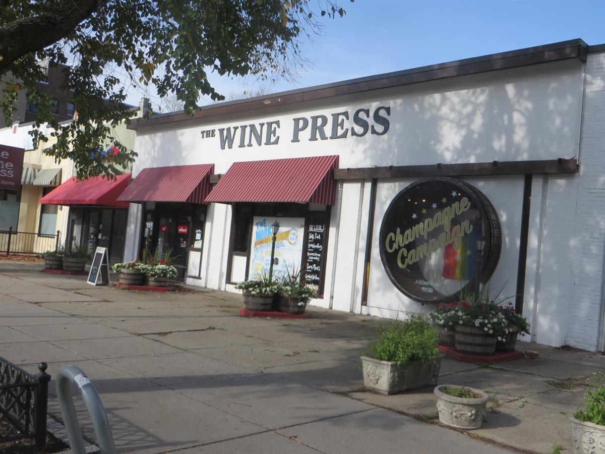
370 Washington St
Built:
1850Class:
General Office BuildingLand area:
6,132 sfFAR:
0.70Owner:
370 Wash LLCFY26:
$2,654,900 Δ-0.78%| FY | Assessed | Change |
| 26 | $2,654,900 | -0.78% |
| 25 | $2,675,900 | 2.31% |
| 24 | $2,615,500 | 1.94% |
| 23 | $2,565,800 | -0.82% |
| 22 | $2,587,100 | -0.69% |
| 21 | $2,605,200 | -0.14% |
| 20 | $2,608,900 | 6.28% |
| 19 | $2,454,800 | 21.95% |
| 18 | $2,013,000 | 3.39% |
| 17 | $1,947,000 | 5.40% |
| 16 | $1,847,300 | 20.63% |
| 15 | $1,531,400 | 11.09% |
| 14 | $1,378,500 | 13.83% |
| 13 | $1,211,000 | 0.91% |
| 12 | $1,200,100 | 0.00% |
| 11 | $1,200,100 | -4.92% |
| 10 | $1,262,200 | 23.01% |
| 09 | $1,026,100 | 0.01% |
| 08 | $1,026,000 | 7.69% |
| 07 | $952,700 | 1.19% |
| 06 | $941,500 | 30.40% |
| 05 | $722,000 | 10.91% |
| 04 | $651,000 | 7.07% |
| 03 | $608,000 | 5.19% |
| 02 | $578,000 |
70 Beaconsfield Rd
Built:
1917Class:
Two-Family HouseLand area:
8,726 sfFAR:
0.39Owner:
Charu & Lakshmana SwamyFY26:
$2,584,000 Δ-0.28%| FY | Assessed | Change |
| 26 | $2,584,000 | -0.28% |
| 25 | $2,591,300 | 0.42% |
| 24 | $2,580,500 | 8.84% |
| 23 | $2,371,000 | 5.00% |
| 22 | $2,258,100 | 4.00% |
| 21 | $2,171,200 | 1.75% |
| 20 | $2,133,800 | 5.00% |
| 19 | $2,032,200 | 18.80% |
| 18 | $1,710,600 | 7.99% |
| 17 | $1,584,000 | 10.00% |
| 16 | $1,440,000 | 13.95% |
| 15 | $1,263,700 | 5.64% |
| 14 | $1,196,200 | 5.00% |
| 13 | $1,139,200 | 0.00% |
| 12 | $1,139,200 | -0.54% |
| 11 | $1,145,400 | 0.00% |
| 10 | $1,145,400 | -0.01% |
| 09 | $1,145,500 | 4.57% |
| 08 | $1,095,400 | -2.00% |
| 07 | $1,117,800 | -0.92% |
| 06 | $1,128,200 | 3.92% |
| 05 | $1,085,600 | 7.00% |
| 04 | $1,014,600 | 10.00% |
| 03 | $922,400 | 40.25% |
| 02 | $657,700 |
100 Woodcliff Rd
Built:
1954Class:
Single Family HouseLand area:
9,042 sfFAR:
0.17Owner:
100 Woodcliff LLCFY26:
$1,209,700 Δ5.51%| FY | Assessed | Change |
| 26 | $1,209,700 | 5.51% |
| 25 | $1,146,500 | 3.93% |
| 24 | $1,103,100 | 13.75% |
| 23 | $969,800 | 5.01% |
| 22 | $923,500 | 4.00% |
| 21 | $888,000 | 12.04% |
| 20 | $792,600 | 2.62% |
| 19 | $772,400 | 1.43% |
| 18 | $761,500 | 3.86% |
| 17 | $733,200 | 0.00% |
| 16 | $733,200 | 1.78% |
| 15 | $720,400 | 4.83% |
| 14 | $687,200 | 1.45% |
| 13 | $677,400 | 0.00% |
| 12 | $677,400 | 12.45% |
| 11 | $602,400 | 9.09% |
| 10 | $552,200 | 0.00% |
| 09 | $552,200 | 4.90% |
| 08 | $526,400 | -4.27% |
| 07 | $549,900 | -0.11% |
| 06 | $550,500 | 6.46% |
| 05 | $517,100 | 6.99% |
| 04 | $483,300 | 10.02% |
| 03 | $439,300 | -0.61% |
| 02 | $442,000 |
Historic name:
Silverman, Maurice HouseNeighborhood:
South Brookline; PutterhamArchitect(s):
Williams, Ralph I.Style(s):
Postwar Traditional; RanchUse(s):
Single Family Dwelling HouseSignificance(s):
Architecture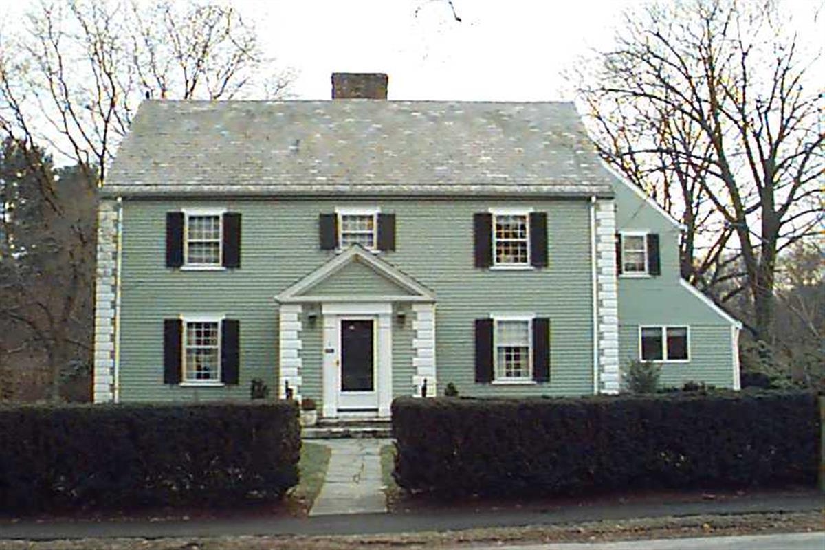
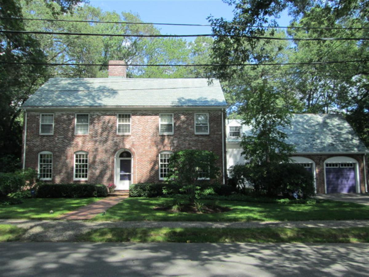
3 Glenoe Rd
Built:
1936Class:
Single Family HouseLand area:
17,583 sfFAR:
0.21Owner:
3 Glenoe Road LLCFY26:
$2,832,700 Δ-1.37%| FY | Assessed | Change |
| 26 | $2,832,700 | -1.37% |
| 25 | $2,872,100 | 3.77% |
| 24 | $2,767,800 | 11.22% |
| 23 | $2,488,500 | 5.00% |
| 22 | $2,370,100 | 4.01% |
| 21 | $2,278,800 | 4.98% |
| 20 | $2,170,800 | 5.00% |
| 19 | $2,067,400 | 1.24% |
| 18 | $2,042,000 | 6.00% |
| 17 | $1,926,500 | 7.00% |
| 16 | $1,800,500 | 7.01% |
| 15 | $1,682,600 | 1.94% |
| 14 | $1,650,500 | 3.00% |
| 13 | $1,602,400 | 0.00% |
| 12 | $1,602,400 | 6.56% |
| 11 | $1,503,700 | 0.00% |
| 10 | $1,503,700 | 0.36% |
| 09 | $1,498,300 | -0.43% |
| 08 | $1,504,800 | -4.00% |
| 07 | $1,567,500 | -0.01% |
| 06 | $1,567,600 | 13.41% |
| 05 | $1,382,200 | 7.00% |
| 04 | $1,291,800 | 10.00% |
| 03 | $1,174,400 | 17.16% |
| 02 | $1,002,400 |
Historic name:
McCarthy, Louis B. HouseNeighborhood:
WoodlandArchitect(s):
Jacobs, William NelsonStyle(s):
Colonial RevivalUse(s):
Single Family Dwelling HouseSignificance(s):
Architecture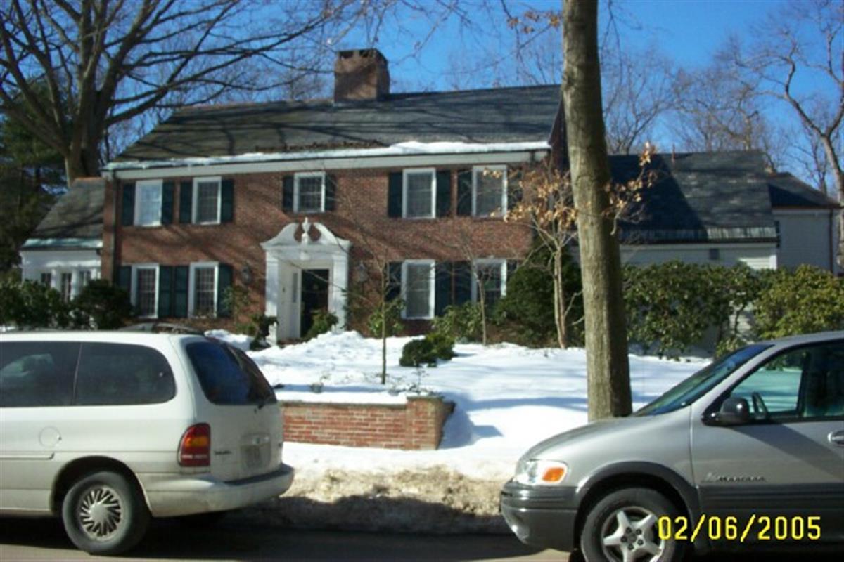
97 Laurel Rd
Built:
1937Class:
Single Family HouseLand area:
43,181 sfFAR:
0.11Owner:
Derek E & Elizabeth H TaffFY26:
$4,667,700 Δ0.47%| FY | Assessed | Change |
| 26 | $4,667,700 | 0.47% |
| 25 | $4,645,900 | 1.67% |
| 24 | $4,569,500 | 11.96% |
| 23 | $4,081,200 | 5.00% |
| 22 | $3,886,800 | -4.91% |
| 21 | $4,087,600 | 5.03% |
| 20 | $3,891,900 | 5.00% |
| 19 | $3,706,600 | -0.84% |
| 18 | $3,737,900 | 6.00% |
| 17 | $3,526,300 | 7.00% |
| 16 | $3,295,600 | 6.96% |
| 15 | $3,081,100 | 2.84% |
| 14 | $2,996,100 | 3.00% |
| 13 | $2,908,800 | 0.00% |
| 12 | $2,908,800 | 5.98% |
| 11 | $2,744,700 | 0.00% |
| 10 | $2,744,700 | -0.03% |
| 09 | $2,745,600 | 3.52% |
| 08 | $2,652,300 | -4.00% |
| 07 | $2,762,800 | -0.04% |
| 06 | $2,764,000 | 32.93% |
| 05 | $2,079,300 | 7.00% |
| 04 | $1,943,300 | 10.07% |
| 03 | $1,765,500 | 27.70% |
| 02 | $1,382,500 |
Historic name:
Pemberton, Dr. Frank A. HouseNeighborhood:
WoodlandArchitect(s):
Stowell, Raymond MilesStyle(s):
Colonial RevivalUse(s):
Single Family Dwelling HouseSignificance(s):
Architecture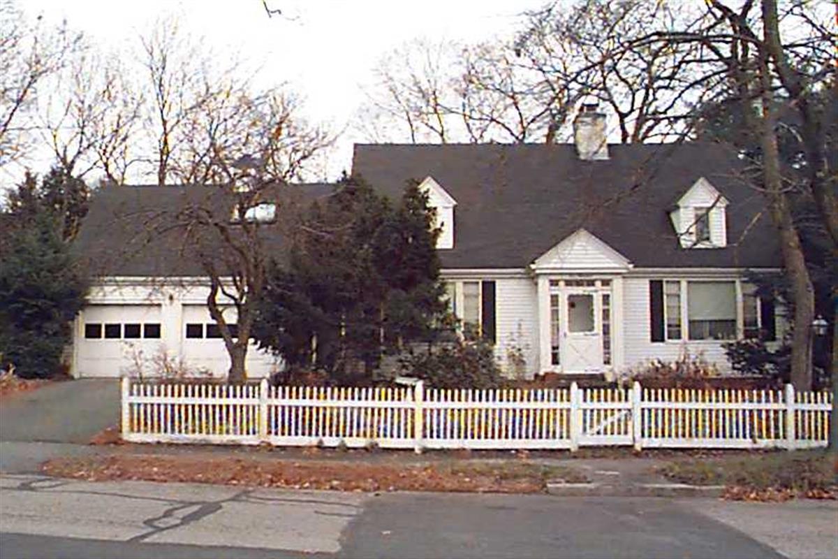
100 Bellingham Rd
Built:
1942Class:
Religious PropertyLand area:
16,544 sfFAR:
0.15Owner:
Chabad Lubavitch Of Chestnut Hill IncFY26:
$1,500,700 Δ25.86%| FY | Assessed | Change |
| 26 | $1,500,700 | 25.86% |
| 25 | $1,192,400 | -9.99% |
| 24 | $1,324,700 | 10.17% |
| 23 | $1,202,400 | 5.00% |
| 22 | $1,145,100 | 4.00% |
| 21 | $1,101,100 | 5.92% |
| 20 | $1,039,600 | 4.99% |
| 19 | $990,200 | 4.07% |
| 18 | $951,500 | 6.00% |
| 17 | $897,600 | 7.00% |
| 16 | $838,900 | 9.70% |
| 15 | $764,700 | 7.09% |
| 14 | $714,100 | 3.00% |
| 13 | $693,300 | 0.00% |
| 12 | $693,300 | 3.68% |
| 11 | $668,700 | 0.00% |
| 10 | $668,700 | 0.00% |
| 09 | $668,700 | -1.43% |
| 08 | $678,400 | -3.25% |
| 07 | $701,200 | -0.79% |
| 06 | $706,800 | 12.96% |
| 05 | $625,700 | 6.99% |
| 04 | $584,800 | 10.01% |
| 03 | $531,600 | 7.05% |
| 02 | $496,600 |
90 Bellingham Rd
Built:
1949Class:
Religious PropertyLand area:
11,518 sfFAR:
0.17Owner:
Chabad Lubavitch Of Chestnut Hill IncFY26:
$1,388,200 Δ23.11%| FY | Assessed | Change |
| 26 | $1,388,200 | 23.11% |
| 25 | $1,127,600 | -8.13% |
| 24 | $1,227,400 | 11.01% |
| 23 | $1,105,700 | 4.99% |
| 22 | $1,053,100 | 4.00% |
| 21 | $1,012,600 | 6.15% |
| 20 | $953,900 | 5.01% |
| 19 | $908,400 | 1.59% |
| 18 | $894,200 | 6.00% |
| 17 | $843,600 | 11.63% |
| 16 | $755,700 | 6.99% |
| 15 | $706,300 | 7.88% |
| 14 | $654,700 | 3.01% |
| 13 | $635,600 | 0.00% |
| 12 | $635,600 | 0.03% |
| 11 | $635,400 | 0.00% |
| 10 | $635,400 | 0.00% |
| 09 | $635,400 | 5.83% |
| 08 | $600,400 | -4.00% |
| 07 | $625,400 | 0.00% |
| 06 | $625,400 | 7.25% |
| 05 | $583,100 | 6.99% |
| 04 | $545,000 | 10.01% |
| 03 | $495,400 | 7.32% |
| 02 | $461,600 |
145 Woodland Rd
Built:
1922Class:
Single Family HouseLand area:
27,387 sfFAR:
0.12Owner:
Louis B Harding 4ThFY26:
$2,980,400 Δ6.07%| FY | Assessed | Change |
| 26 | $2,980,400 | 6.07% |
| 25 | $2,809,800 | 3.91% |
| 24 | $2,704,000 | 10.60% |
| 23 | $2,444,900 | 5.00% |
| 22 | $2,328,500 | 4.00% |
| 21 | $2,239,000 | 6.61% |
| 20 | $2,100,200 | 5.00% |
| 19 | $2,000,100 | -2.33% |
| 18 | $2,047,900 | 6.61% |
| 17 | $1,920,900 | 7.00% |
| 16 | $1,795,200 | 7.00% |
| 15 | $1,677,800 | 8.46% |
| 14 | $1,546,900 | 3.00% |
| 13 | $1,501,800 | 0.00% |
| 12 | $1,501,800 | 5.57% |
| 11 | $1,422,500 | 0.00% |
| 10 | $1,422,500 | 0.25% |
| 09 | $1,418,900 | -1.14% |
| 08 | $1,435,300 | -4.00% |
| 07 | $1,495,100 | 0.00% |
| 06 | $1,495,100 | 2.83% |
| 05 | $1,454,000 | 7.01% |
| 04 | $1,358,800 | 10.00% |
| 03 | $1,235,300 | 25.01% |
| 02 | $988,200 |
Historic name:
Harding, Louis B. HouseNeighborhood:
WoodlandStyle(s):
Colonial Revival; English RevivalUse(s):
Single Family Dwelling HouseSignificance(s):
ArchitectureClick on the map or address list to view building info.
Address (MHC ID)
- 319 Mason Ter
- 2 City View Rd
- 18 Cypress St
- 213 Gardner Rd (764)
- 31-A Harvard St (2475)
- 49 Babcock St
- 49 Davis Ave
- 14 Harvard St (2560)
- 1495 Beacon St
- 282 Newton St (1705)
- 11 Naples Rd
- 7 Cedar Rd (3284)
- 119 Hyslop Rd (1488)
- 27 White Pl (1946)
- 80 Greenough St
- 45 Beverly Rd
- 48-54 White Pl (1958)
- 52 Beverly Rd
- 25 Fisher Ave (2049)
- 129 Walnut St (2275)
- 43 Fairgreen Pl
- 1020-A Beacon St (1791)
- 1022 Beacon St (1792)
- 278 Clinton Rd (2024)
- 29 Goodnough Rd
- 70 Beaconsfield Rd
- 102 Dean Rd (2037)
- 194 Lancaster Ter (2972)
- 370 Washington St
- 70 Beaconsfield Rd
- 100 Woodcliff Rd (3353)
- 3 Glenoe Rd (3464)
- 97 Laurel Rd (3307)
- 100 Bellingham Rd
- 90 Bellingham Rd
- 145 Woodland Rd (3479)