Endangered
An application has been made to demolish or significantly alter these buildings.
If a property is deemed to have historic merit, the Town has the option of placing a stay of demolition for up to 12 months — or 18 months for National Register properties — to allow the Town and the owner to discuss alternatives to demolition of the property.
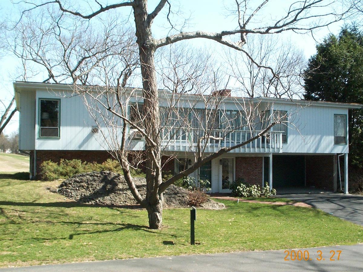
43 Fairgreen Pl
Built:
1962Class:
Single Family HouseLand area:
21,184 sfFAR:
0.10Owner:
Aces Development LLCFY26:
$2,126,900 Δ5.74%| FY | Assessed | Change |
| 26 | $2,126,900 | 5.74% |
| 25 | $2,011,400 | 4.11% |
| 24 | $1,932,000 | 13.79% |
| 23 | $1,697,800 | 5.01% |
| 22 | $1,616,800 | 3.99% |
| 21 | $1,554,700 | 6.90% |
| 20 | $1,454,400 | 5.00% |
| 19 | $1,385,200 | -4.35% |
| 18 | $1,448,200 | 6.00% |
| 17 | $1,366,200 | 7.00% |
| 16 | $1,276,800 | 7.00% |
| 15 | $1,193,300 | 9.50% |
| 14 | $1,089,800 | 3.00% |
| 13 | $1,058,100 | 0.00% |
| 12 | $1,058,100 | 1.40% |
| 11 | $1,043,500 | -0.49% |
| 10 | $1,048,600 | 0.41% |
| 09 | $1,044,300 | -1.38% |
| 08 | $1,058,900 | -4.00% |
| 07 | $1,103,000 | -0.03% |
| 06 | $1,103,300 | 4.35% |
| 05 | $1,057,300 | 7.00% |
| 04 | $988,100 | 10.00% |
| 03 | $898,300 | 23.58% |
| 02 | $726,900 |
Demolition allowed:
2025-01-14partial demolition, National Register district
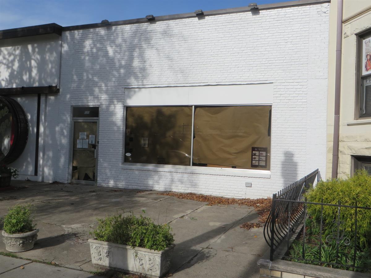
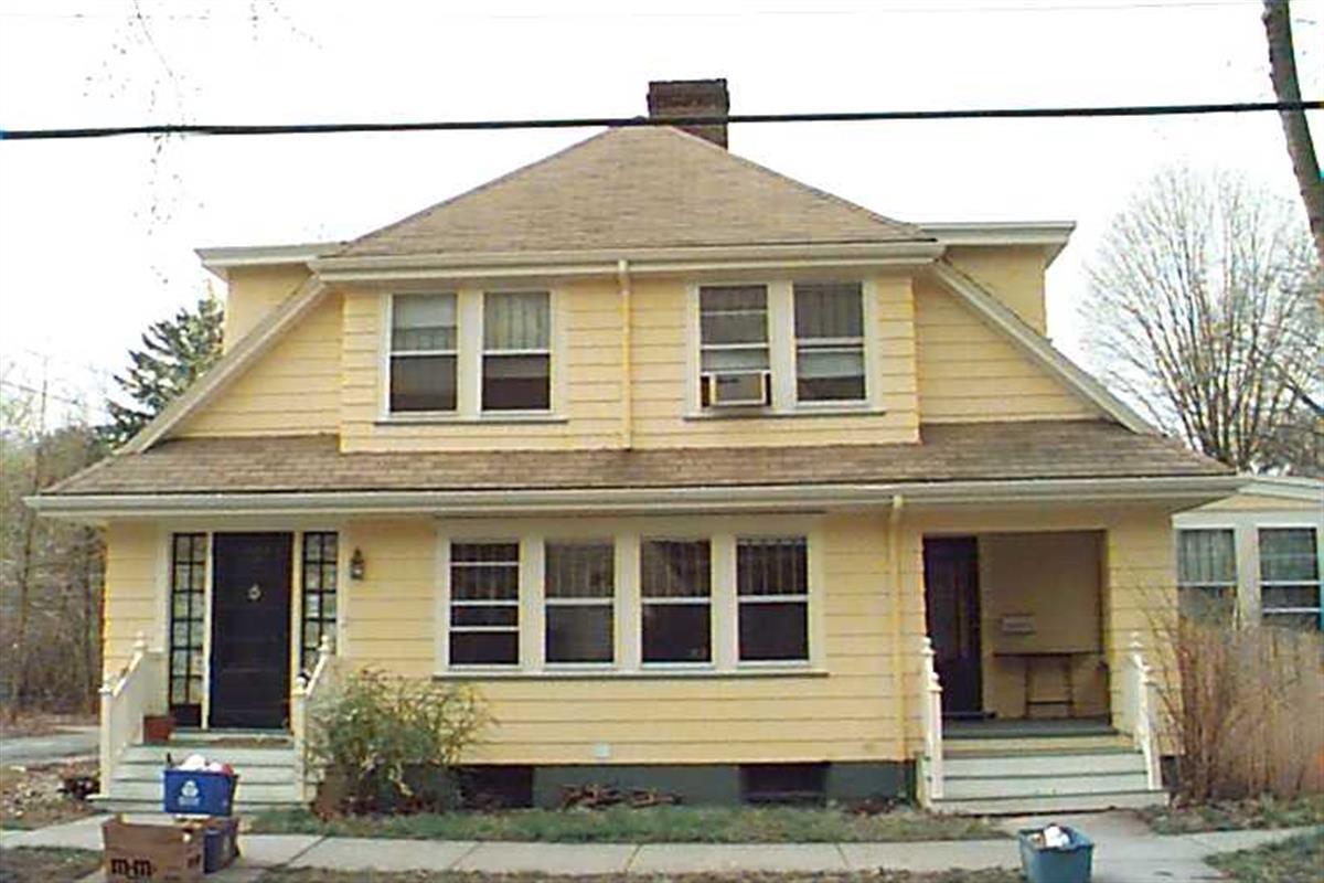
1020-A Beacon St
Built:
1940Class:
Small RetailLand area:
4,050 sfFAR:
0.41Owner:
Sean D Galvin, Tr; C/O 1020-1024 Beacon St RealtyFY26:
$1,577,800 Δ0.42%| FY | Assessed | Change |
| 26 | $1,577,800 | 0.42% |
| 25 | $1,571,200 | 2.05% |
| 24 | $1,539,600 | 0.00% |
| 23 | $1,539,600 | 0.00% |
| 22 | $1,539,600 | 0.00% |
| 21 | $1,539,600 | 0.00% |
| 20 | $1,539,600 | 7.49% |
| 19 | $1,432,300 | 15.65% |
| 18 | $1,238,500 | 14.28% |
| 17 | $1,083,700 | 6.06% |
| 16 | $1,021,800 | 10.00% |
| 15 | $928,900 | 31.46% |
| 14 | $706,600 | 7.14% |
| 13 | $659,500 | -2.66% |
| 12 | $677,500 | 7.05% |
| 11 | $632,900 | -1.65% |
| 10 | $643,500 | 0.81% |
| 09 | $638,300 | -0.33% |
| 08 | $640,400 | 5.87% |
| 07 | $604,900 | -2.59% |
| 06 | $621,000 | 50.36% |
| 05 | $413,000 | 11.02% |
| 04 | $372,000 | 6.90% |
| 03 | $348,000 | 0.29% |
| 02 | $347,000 |
Historic name:
Goodman, I. H. BuildingNeighborhood:
Saint Mary's Street; Beacon StreetArchitect(s):
Moffie, Saul E.Style(s):
Not researchedUse(s):
UndeterminedSignificance(s):
ArchitectureDesignation(s):
Nat'l Register District (10/17/1985); Nat'l Register MRA (10/17/1985)Demolition allowed:
2025-01-14partial demolition, National Register district
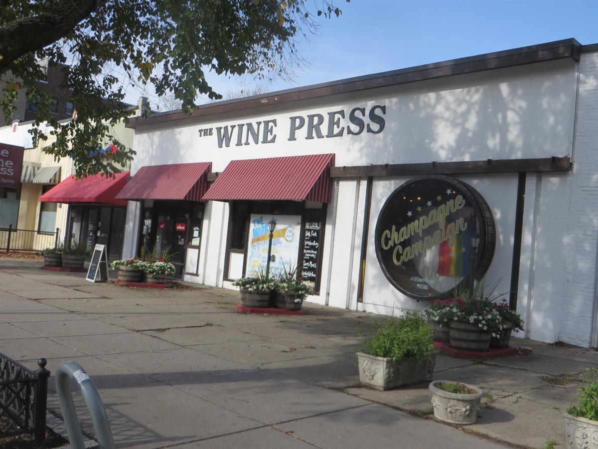
1022 Beacon St
Built:
1920Class:
Small RetailLand area:
7,726 sfFAR:
0.30Owner:
Sean D Galvin, Tr; C/O 1020-1024 Beacon St RealtyFY26:
$2,213,700 Δ1.33%| FY | Assessed | Change |
| 26 | $2,213,700 | 1.33% |
| 25 | $2,184,600 | 2.14% |
| 24 | $2,138,900 | 0.00% |
| 23 | $2,138,900 | 0.00% |
| 22 | $2,138,900 | 0.00% |
| 21 | $2,138,900 | 0.00% |
| 20 | $2,138,900 | 5.14% |
| 19 | $2,034,300 | 13.79% |
| 18 | $1,787,700 | 7.00% |
| 17 | $1,670,800 | 7.01% |
| 16 | $1,561,300 | 6.01% |
| 15 | $1,472,800 | 18.76% |
| 14 | $1,240,200 | 5.16% |
| 13 | $1,179,300 | -2.44% |
| 12 | $1,208,800 | -6.79% |
| 11 | $1,296,900 | -1.65% |
| 10 | $1,318,600 | -5.12% |
| 09 | $1,389,800 | 4.34% |
| 08 | $1,332,000 | 5.88% |
| 07 | $1,258,000 | 1.19% |
| 06 | $1,243,200 | 0.83% |
| 05 | $1,233,000 | 10.88% |
| 04 | $1,112,000 | 7.13% |
| 03 | $1,038,000 | 0.19% |
| 02 | $1,036,000 |
Historic name:
Rotman and Babbitt BuildingNeighborhood:
Saint Mary's Street; Beacon StreetArchitect(s):
Norcross, Frederick A.Style(s):
Not researchedUse(s):
UndeterminedSignificance(s):
ArchitectureDesignation(s):
Nat'l Register District (10/17/1985); Nat'l Register MRA (10/17/1985)Demolition delayed to:
2026-06-10partial demolition, National Register district
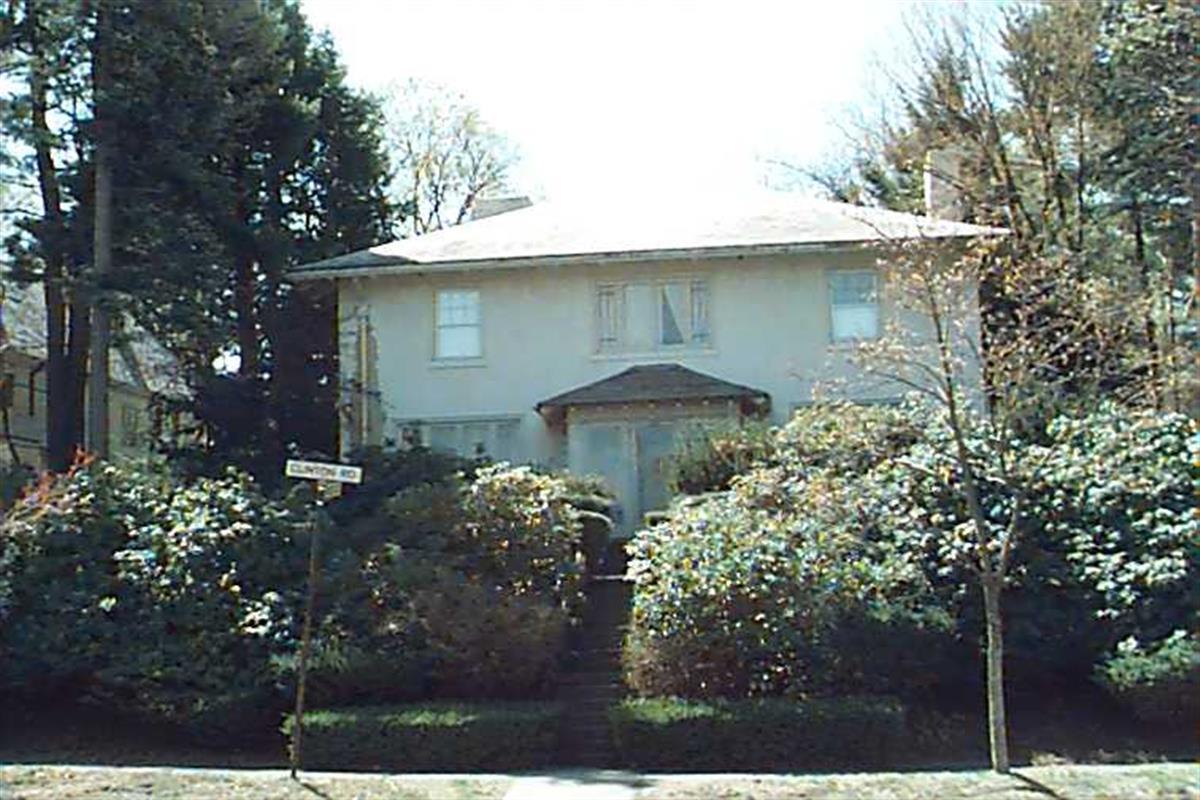
278 Clinton Rd
Built:
1911Class:
Single Family HouseLand area:
12,970 sfFAR:
0.33Owner:
278 Clinton Road LLCFY26:
$2,695,200 Δ-0.31%| FY | Assessed | Change |
| 26 | $2,695,200 | -0.31% |
| 25 | $2,703,700 | 3.94% |
| 24 | $2,601,200 | 17.06% |
| 23 | $2,222,200 | 5.00% |
| 22 | $2,116,300 | 4.00% |
| 21 | $2,034,900 | 5.46% |
| 20 | $1,929,600 | 5.00% |
| 19 | $1,837,700 | 0.32% |
| 18 | $1,831,800 | -7.65% |
| 17 | $1,983,500 | 7.00% |
| 16 | $1,853,800 | 7.00% |
| 15 | $1,732,500 | 5.42% |
| 14 | $1,643,500 | 3.00% |
| 13 | $1,595,600 | 0.00% |
| 12 | $1,595,600 | 3.58% |
| 11 | $1,540,500 | 0.00% |
| 10 | $1,540,500 | 0.12% |
| 09 | $1,538,600 | -1.11% |
| 08 | $1,555,900 | -4.00% |
| 07 | $1,620,700 | 0.01% |
| 06 | $1,620,600 | 11.23% |
| 05 | $1,457,000 | 7.00% |
| 04 | $1,361,700 | 10.00% |
| 03 | $1,237,900 | 23.41% |
| 02 | $1,003,100 |
Historic name:
Wilson HouseNeighborhood:
Fisher HillArchitect(s):
Low, Frederic F.Style(s):
Not researchedUse(s):
Single Family Dwelling HouseSignificance(s):
ArchitectureDesignation(s):
Nat'l Register District (10/17/1985); Nat'l Register MRA (10/17/1985)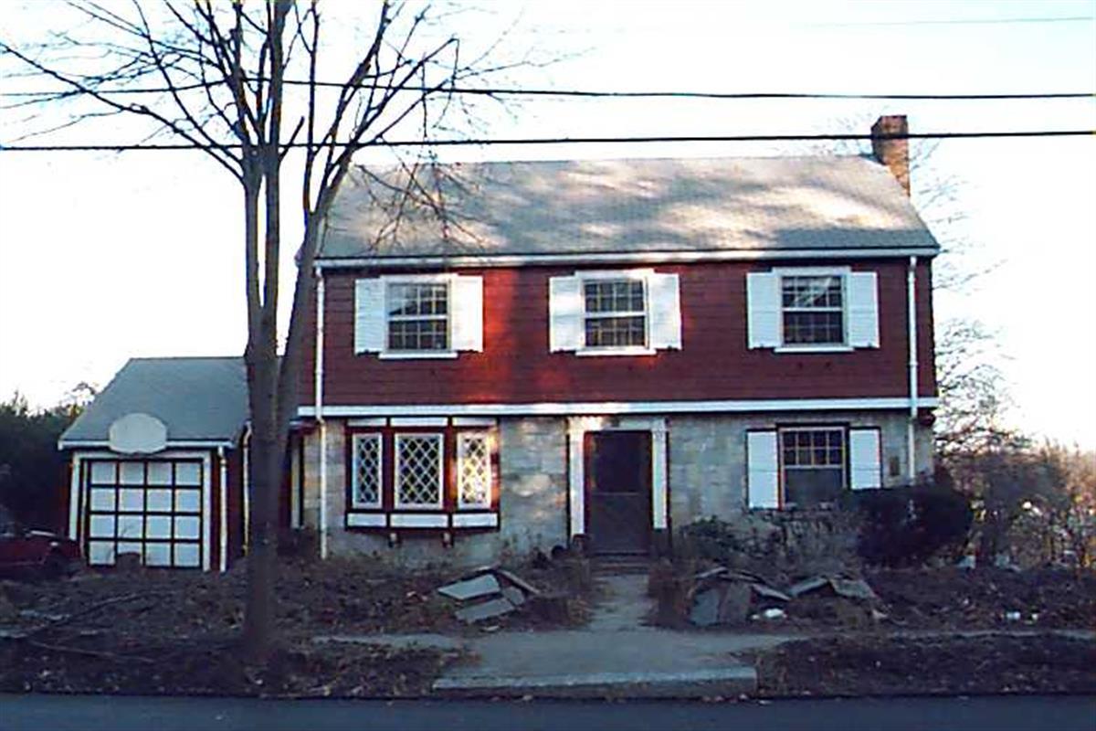
29 Goodnough Rd
Built:
2025Class:
Single Family HouseLand area:
7,572 sfFAR:
0.40Owner:
Alexa F SheinkopfFY26:
$1,007,000 Δ7.08%| FY | Assessed | Change |
| 26 | $1,007,000 | 7.08% |
| 25 | $940,400 | 4.00% |
| 24 | $904,200 | 16.75% |
| 23 | $774,500 | 5.00% |
| 22 | $737,600 | 4.00% |
| 21 | $709,200 | 7.21% |
| 20 | $661,500 | 5.00% |
| 19 | $630,000 | -0.94% |
| 18 | $636,000 | 6.00% |
| 17 | $600,000 | 6.99% |
| 16 | $560,800 | 7.00% |
| 15 | $524,100 | 1.51% |
| 14 | $516,300 | 2.99% |
| 13 | $501,300 | 0.00% |
| 12 | $501,300 | 3.83% |
| 11 | $482,800 | 0.00% |
| 10 | $482,800 | 0.00% |
| 09 | $482,800 | 1.39% |
| 08 | $476,200 | -3.99% |
| 07 | $496,000 | 0.00% |
| 06 | $496,000 | 7.66% |
| 05 | $460,700 | 6.99% |
| 04 | $430,600 | 10.02% |
| 03 | $391,400 | -2.15% |
| 02 | $400,000 |
70 Beaconsfield Rd
Built:
1917Class:
Two-Family HouseLand area:
8,726 sfFAR:
0.39Owner:
Charu & Lakshmana SwamyFY26:
$2,584,000 Δ-0.28%| FY | Assessed | Change |
| 26 | $2,584,000 | -0.28% |
| 25 | $2,591,300 | 0.42% |
| 24 | $2,580,500 | 8.84% |
| 23 | $2,371,000 | 5.00% |
| 22 | $2,258,100 | 4.00% |
| 21 | $2,171,200 | 1.75% |
| 20 | $2,133,800 | 5.00% |
| 19 | $2,032,200 | 18.80% |
| 18 | $1,710,600 | 7.99% |
| 17 | $1,584,000 | 10.00% |
| 16 | $1,440,000 | 13.95% |
| 15 | $1,263,700 | 5.64% |
| 14 | $1,196,200 | 5.00% |
| 13 | $1,139,200 | 0.00% |
| 12 | $1,139,200 | -0.54% |
| 11 | $1,145,400 | 0.00% |
| 10 | $1,145,400 | -0.01% |
| 09 | $1,145,500 | 4.57% |
| 08 | $1,095,400 | -2.00% |
| 07 | $1,117,800 | -0.92% |
| 06 | $1,128,200 | 3.92% |
| 05 | $1,085,600 | 7.00% |
| 04 | $1,014,600 | 10.00% |
| 03 | $922,400 | 40.25% |
| 02 | $657,700 |

102 Dean Rd
Built:
1907Class:
Single Family HouseLand area:
16,656 sfFAR:
0.35Owner:
Mikhail KutuzovFY26:
$5,198,700 Δ1.58%| FY | Assessed | Change |
| 26 | $5,198,700 | 1.58% |
| 25 | $5,117,900 | 3.67% |
| 24 | $4,936,500 | 190.66% |
| 23 | $1,698,400 | 5.01% |
| 22 | $1,617,400 | 4.00% |
| 21 | $1,555,200 | 7.30% |
| 20 | $1,449,400 | 5.00% |
| 19 | $1,380,400 | 0.78% |
| 18 | $1,369,700 | 6.10% |
| 17 | $1,291,000 | 7.00% |
| 16 | $1,206,500 | 7.00% |
| 15 | $1,127,600 | 2.65% |
| 14 | $1,098,500 | 3.00% |
| 13 | $1,066,500 | 0.00% |
| 12 | $1,066,500 | 6.34% |
| 11 | $1,002,900 | 0.00% |
| 10 | $1,002,900 | 0.20% |
| 09 | $1,000,900 | -17.84% |
| 08 | $1,218,200 | -4.00% |
| 07 | $1,269,000 | 0.00% |
| 06 | $1,269,000 | 6.48% |
| 05 | $1,191,800 | 7.00% |
| 04 | $1,113,800 | 9.99% |
| 03 | $1,012,600 | 16.31% |
| 02 | $870,600 |
Historic name:
Stewart, Ralph HouseNeighborhood:
Fisher HillArchitect(s):
Kilham and Hopkins; Kilham, Hopkins and Greeley; Mowell, GregoryStyle(s):
Colonial RevivalUse(s):
Single Family Dwelling HouseSignificance(s):
ArchitectureDesignation(s):
Nat'l Register District (10/17/1985); Nat'l Register MRA (10/17/1985)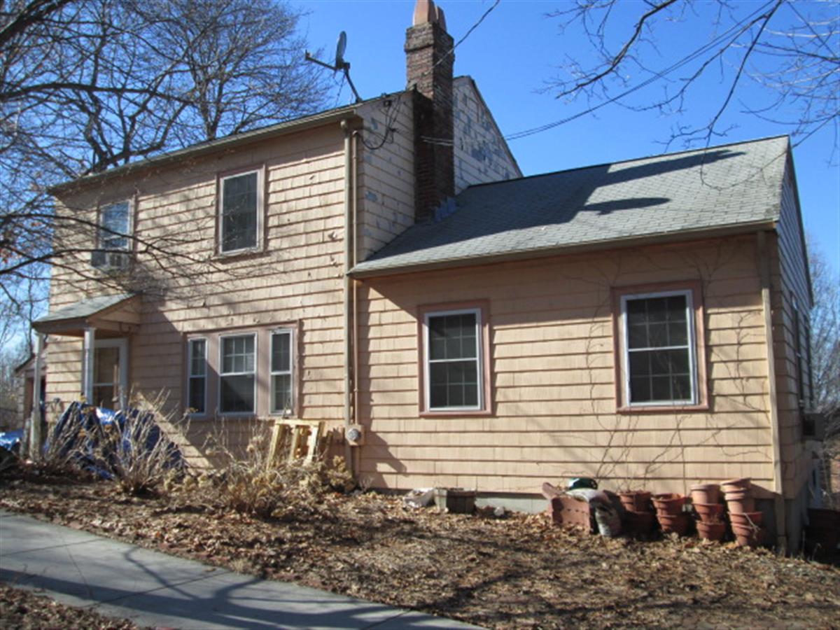
194 Lancaster Ter
Built:
1941Class:
Single Family HouseLand area:
7,585 sfFAR:
0.21Owner:
Akbar Ansari; Syeda AmeernazFY26:
$2,007,700 Δ2.46%| FY | Assessed | Change |
| 26 | $2,007,700 | 2.46% |
| 25 | $1,959,500 | 4.04% |
| 24 | $1,883,500 | 10.70% |
| 23 | $1,701,400 | 4.99% |
| 22 | $1,620,500 | 4.00% |
| 21 | $1,558,100 | 10.19% |
| 20 | $1,414,000 | 5.00% |
| 19 | $1,346,700 | 11.95% |
| 18 | $1,202,900 | 6.00% |
| 17 | $1,134,800 | 7.00% |
| 16 | $1,060,600 | 19.10% |
| 15 | $890,500 | 6.08% |
| 14 | $839,500 | 3.01% |
| 13 | $815,000 | 0.00% |
| 12 | $815,000 | 2.36% |
| 11 | $796,200 | 0.00% |
| 10 | $796,200 | 0.00% |
| 09 | $796,200 | 5.82% |
| 08 | $752,400 | -2.72% |
| 07 | $773,400 | -0.04% |
| 06 | $773,700 | 14.03% |
| 05 | $678,500 | 7.02% |
| 04 | $634,000 | 12.43% |
| 03 | $563,900 | 10.29% |
| 02 | $511,300 |
Historic name:
Orlando, John - Romanov, Dr. David HouseNeighborhood:
Corey HillArchitect(s):
Orlando, FrankStyle(s):
No styleUse(s):
Single Family Dwelling HouseSignificance(s):
Architecture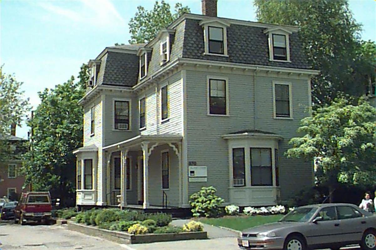
370 Washington St
Built:
1850Class:
General Office BuildingLand area:
6,132 sfFAR:
0.70Owner:
370 Wash LLCFY26:
$2,654,900 Δ-0.78%| FY | Assessed | Change |
| 26 | $2,654,900 | -0.78% |
| 25 | $2,675,900 | 2.31% |
| 24 | $2,615,500 | 1.94% |
| 23 | $2,565,800 | -0.82% |
| 22 | $2,587,100 | -0.69% |
| 21 | $2,605,200 | -0.14% |
| 20 | $2,608,900 | 6.28% |
| 19 | $2,454,800 | 21.95% |
| 18 | $2,013,000 | 3.39% |
| 17 | $1,947,000 | 5.40% |
| 16 | $1,847,300 | 20.63% |
| 15 | $1,531,400 | 11.09% |
| 14 | $1,378,500 | 13.83% |
| 13 | $1,211,000 | 0.91% |
| 12 | $1,200,100 | 0.00% |
| 11 | $1,200,100 | -4.92% |
| 10 | $1,262,200 | 23.01% |
| 09 | $1,026,100 | 0.01% |
| 08 | $1,026,000 | 7.69% |
| 07 | $952,700 | 1.19% |
| 06 | $941,500 | 30.40% |
| 05 | $722,000 | 10.91% |
| 04 | $651,000 | 7.07% |
| 03 | $608,000 | 5.19% |
| 02 | $578,000 |
70 Beaconsfield Rd
Built:
1917Class:
Two-Family HouseLand area:
8,726 sfFAR:
0.39Owner:
Charu & Lakshmana SwamyFY26:
$2,584,000 Δ-0.28%| FY | Assessed | Change |
| 26 | $2,584,000 | -0.28% |
| 25 | $2,591,300 | 0.42% |
| 24 | $2,580,500 | 8.84% |
| 23 | $2,371,000 | 5.00% |
| 22 | $2,258,100 | 4.00% |
| 21 | $2,171,200 | 1.75% |
| 20 | $2,133,800 | 5.00% |
| 19 | $2,032,200 | 18.80% |
| 18 | $1,710,600 | 7.99% |
| 17 | $1,584,000 | 10.00% |
| 16 | $1,440,000 | 13.95% |
| 15 | $1,263,700 | 5.64% |
| 14 | $1,196,200 | 5.00% |
| 13 | $1,139,200 | 0.00% |
| 12 | $1,139,200 | -0.54% |
| 11 | $1,145,400 | 0.00% |
| 10 | $1,145,400 | -0.01% |
| 09 | $1,145,500 | 4.57% |
| 08 | $1,095,400 | -2.00% |
| 07 | $1,117,800 | -0.92% |
| 06 | $1,128,200 | 3.92% |
| 05 | $1,085,600 | 7.00% |
| 04 | $1,014,600 | 10.00% |
| 03 | $922,400 | 40.25% |
| 02 | $657,700 |