Endangered
An application has been made to demolish or significantly alter these buildings.
If a property is deemed to have historic merit, the Town has the option of placing a stay of demolition for up to 12 months — or 18 months for National Register properties — to allow the Town and the owner to discuss alternatives to demolition of the property.
Demolition hearing:
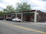
2026-01-1314 Harvard St
Built:
1910Class:
Small RetailLand area:
11,104 sfFAR:
0.48Owner:
Jerome M Tuck, TrFY26:
$4,607,700 Δ2.77%| FY | Assessed | Change |
| 26 | $4,607,700 | 2.77% |
| 25 | $4,483,300 | 1.87% |
| 24 | $4,400,900 | 9.40% |
| 23 | $4,022,700 | 3.16% |
| 22 | $3,899,600 | -4.53% |
| 21 | $4,084,600 | 0.00% |
| 20 | $4,084,600 | 5.36% |
| 19 | $3,876,800 | 23.26% |
| 18 | $3,145,300 | 5.83% |
| 17 | $2,971,900 | 8.33% |
| 16 | $2,743,300 | 7.69% |
| 15 | $2,547,400 | 28.81% |
| 14 | $1,977,600 | 5.17% |
| 13 | $1,880,400 | 3.64% |
| 12 | $1,814,400 | -2.07% |
| 11 | $1,852,800 | -1.65% |
| 10 | $1,883,800 | 9.66% |
| 09 | $1,717,900 | 6.36% |
| 08 | $1,615,100 | 5.88% |
| 07 | $1,525,400 | 1.19% |
| 06 | $1,507,400 | -2.81% |
| 05 | $1,551,000 | 10.86% |
| 04 | $1,399,000 | 7.04% |
| 03 | $1,307,000 | 17.01% |
| 02 | $1,117,000 |
Neighborhood:
Brookline VillageStyle(s):
Classical RevivalUse(s):
Commercial BlockSignificance(s):
Architecture; CommerceDemolition allowed:
2025-12-09partial demolition, National Register district
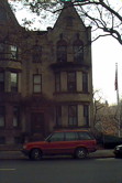
1495 Beacon St
Built:
1900Units:
4Class:
Residential CondominiumFY26:
$2,842,900 Δ5.33%Repeat search and uncheck condominium consolidation to view info by unit.
| FY | Assessed | Change |
| 26 | $2,842,900 | 5.33% |
| 25 | $2,699,000 | -0.12% |
| 24 | $2,702,200 | 1.32% |
| 23 | $2,667,100 | 7.66% |
| 22 | $2,477,300 | 1.00% |
| 21 | $2,452,800 | 0.99% |
| 20 | $2,428,700 | 5.00% |
| 19 | $2,313,000 | 6.83% |
| 18 | $2,165,200 | 8.01% |
| 17 | $2,004,700 | 10.00% |
| 16 | $1,822,500 | 10.01% |
| 15 | $1,656,700 | 10.66% |
| 14 | $1,497,100 | 4.99% |
| 13 | $1,425,900 | -0.37% |
| 12 | $1,431,200 | -1.71% |
| 11 | $1,456,100 | 0.80% |
| 10 | $1,444,600 | 0.00% |
| 09 | $1,444,600 | 3.16% |
| 08 | $1,400,300 | -1.99% |
| 07 | $1,428,800 | 2.99% |
| 06 | $1,387,300 | 10.08% |
| 05 | $1,260,300 | 7.00% |
| 04 | $1,177,800 | 6.99% |
| 03 | $1,100,800 | 24.33% |
| 02 | $885,400 |
Demolition allowed:
2025-12-09storage buildings/greenhouse, National Register property
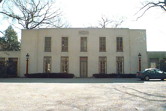
282 Newton St
Built:
c1778Units:
5Class:
Residential with AgriculturalLand area:
2,121,437 sfFAR:
0.02Owner:
Edward P Lawrence, et al TrsFY26:
$23,591,900 Δ2.09%| FY | Assessed | Change |
| 26 | $23,591,900 | 2.09% |
| 25 | $23,109,900 | 1.75% |
| 24 | $22,711,900 | 14.93% |
| 23 | $19,761,000 | 7.57% |
| 22 | $18,370,800 | 2.33% |
| 21 | $17,951,700 | 5.89% |
| 20 | $16,952,600 | 4.55% |
| 19 | $16,215,100 | 5.89% |
| 18 | $15,313,000 | 5.43% |
| 17 | $14,524,300 | 7.89% |
| 16 | $13,461,600 | 8.68% |
| 15 | $12,386,900 | 11.45% |
| 14 | $11,114,700 | 2.96% |
| 13 | $10,795,300 | 0.00% |
| 12 | $10,795,300 | 5.10% |
| 11 | $10,271,000 | 0.10% |
| 10 | $10,260,800 | 0.21% |
| 09 | $10,239,300 | -13.95% |
| 08 | $11,899,700 | -4.03% |
| 07 | $12,399,900 | 0.00% |
| 06 | $12,399,900 | 8.89% |
| 05 | $11,387,500 |
Historic name:
Harris, John House and FarmCommon name:
Allandale FarmNeighborhood:
Mount WalleyStyle(s):
FederalUse(s):
Agricultural; Single Family Dwelling HouseSignificance(s):
Agriculture; ArchitectureDesignation(s):
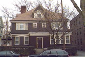
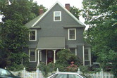
Nat'l Register Individual Property (10/17/1985); Nat'l Register MRA (10/17/1985)11 Naples Rd
Built:
1900Class:
Two-Family HouseLand area:
4,947 sfFAR:
0.61Owner:
Christopher Slomiak; Ming Chou & Jackson C Slomiak TrsFY26:
$1,993,900 Δ0.27%| FY | Assessed | Change |
| 26 | $1,993,900 | 0.27% |
| 25 | $1,988,600 | 1.29% |
| 24 | $1,963,200 | 1.32% |
| 23 | $1,937,600 | 5.01% |
| 22 | $1,845,200 | 4.00% |
| 21 | $1,774,300 | 3.67% |
| 20 | $1,711,500 | 5.00% |
| 19 | $1,630,000 | 11.23% |
| 18 | $1,465,400 | 7.81% |
| 17 | $1,359,200 | 10.00% |
| 16 | $1,235,600 | 10.00% |
| 15 | $1,123,300 | 15.45% |
| 14 | $973,000 | 5.00% |
| 13 | $926,700 | 0.00% |
| 12 | $926,700 | 0.76% |
| 11 | $919,700 | 0.00% |
| 10 | $919,700 | 0.00% |
| 09 | $919,700 | 2.44% |
| 08 | $897,800 | -2.00% |
| 07 | $916,100 | 0.00% |
| 06 | $916,100 | 17.75% |
| 05 | $778,000 | 7.02% |
| 04 | $727,000 | 9.98% |
| 03 | $661,000 | 11.41% |
| 02 | $593,300 |
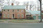
7 Cedar Rd
Built:
1941Class:
Single Family HouseLand area:
21,053 sfFAR:
0.15Owner:
Andres D & Maria J MogollonFY26:
$2,621,900 Δ4.37%| FY | Assessed | Change |
| 26 | $2,621,900 | 4.37% |
| 25 | $2,512,100 | 3.82% |
| 24 | $2,419,700 | 11.79% |
| 23 | $2,164,600 | 5.01% |
| 22 | $2,061,400 | -5.38% |
| 21 | $2,178,500 | 5.45% |
| 20 | $2,065,900 | 5.00% |
| 19 | $1,967,500 | 1.04% |
| 18 | $1,947,300 | 6.00% |
| 17 | $1,837,100 | 10.33% |
| 16 | $1,665,100 | 10.45% |
| 15 | $1,507,600 | 2.61% |
| 14 | $1,469,200 | 4.60% |
| 13 | $1,404,600 | 0.00% |
| 12 | $1,404,600 | 7.18% |
| 11 | $1,310,500 | 12.15% |
| 10 | $1,168,500 | 1.22% |
| 09 | $1,154,400 | -9.78% |
| 08 | $1,279,600 | -4.00% |
| 07 | $1,332,900 | 0.02% |
| 06 | $1,332,700 | 7.03% |
| 05 | $1,245,200 | 7.00% |
| 04 | $1,163,700 | 9.99% |
| 03 | $1,058,000 | 17.58% |
| 02 | $899,800 |
Neighborhood:
WoodlandStyle(s):
Colonial RevivalUse(s):
Single Family Dwelling HouseSignificance(s):
ArchitectureDemolition delayed to:
2027-04-07partial demolition, National Register district
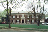
119 Hyslop Rd
Built:
1920Class:
Single Family HouseLand area:
51,748 sfFAR:
0.20Owner:
Paul B & Sandra M EdgerleyFY26:
$11,516,200 Δ-0.69%| FY | Assessed | Change |
| 26 | $11,516,200 | -0.69% |
| 25 | $11,596,200 | 2.89% |
| 24 | $11,270,000 | 13.35% |
| 23 | $9,943,000 | 5.00% |
| 22 | $9,469,600 | 4.00% |
| 21 | $9,105,400 | 3.48% |
| 20 | $8,799,600 | 5.00% |
| 19 | $8,380,600 | 3.11% |
| 18 | $8,127,600 | 6.00% |
| 17 | $7,667,400 | 7.77% |
| 16 | $7,114,600 | 7.00% |
| 15 | $6,649,200 | 2.60% |
| 14 | $6,480,900 | 3.00% |
| 13 | $6,292,100 | 0.00% |
| 12 | $6,292,100 | 4.12% |
| 11 | $6,043,300 | 0.00% |
| 10 | $6,043,300 | 0.06% |
| 09 | $6,039,600 | 3.64% |
| 08 | $5,827,500 | 0.48% |
| 07 | $5,799,600 | 0.05% |
| 06 | $5,796,500 | 22.25% |
| 05 | $4,741,700 | 7.00% |
| 04 | $4,431,500 | 11.31% |
| 03 | $3,981,400 | 35.61% |
| 02 | $2,936,000 |
Historic name:
Hammon, E. C. HouseNeighborhood:
Fisher HillArchitect(s):
Parker, Thomas and RiceStyle(s):
Colonial RevivalUse(s):
Single Family Dwelling HouseSignificance(s):
ArchitectureDesignation(s):
Nat'l Register District (10/17/1985); Nat'l Register MRA (10/17/1985)Demolition allowed:
2025-08-19partial demolition, National Register area
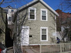
27 White Pl
Built:
1857Class:
Single Family HouseLand area:
2,050 sfFAR:
0.52Owner:
Melody K Morris; Jonathan M GreinerFY26:
$1,421,000 Δ3.09%| FY | Assessed | Change |
| 26 | $1,421,000 | 3.09% |
| 25 | $1,378,400 | 4.64% |
| 24 | $1,317,300 | 19.49% |
| 23 | $1,102,400 | 5.01% |
| 22 | $1,049,800 | 4.00% |
| 21 | $1,009,400 | 7.74% |
| 20 | $936,900 | 5.00% |
| 19 | $892,300 | 8.59% |
| 18 | $821,700 | 6.00% |
| 17 | $775,200 | 7.00% |
| 16 | $724,500 | 7.00% |
| 15 | $677,100 | 5.62% |
| 14 | $641,100 | 21.74% |
| 13 | $526,600 | 0.00% |
| 12 | $526,600 | 1.37% |
| 11 | $519,500 | 0.00% |
| 10 | $519,500 | 0.00% |
| 09 | $519,500 | 14.03% |
| 08 | $455,600 | -4.00% |
| 07 | $474,600 | 0.02% |
| 06 | $474,500 | 24.64% |
| 05 | $380,700 | 7.00% |
| 04 | $355,800 | 9.98% |
| 03 | $323,500 | 23.43% |
| 02 | $262,100 |
Historic name:
Libbey, J. O. HouseNeighborhood:
Brookline Village; White PlaceStyle(s):
Not researchedUse(s):
Single Family Dwelling HouseSignificance(s):
ArchitectureDesignation(s):
Nat'l Register District (10/17/1985); Nat'l Register MRA (10/17/1985)80 Greenough St
Built:
1880Class:
Single Family HouseLand area:
6,447 sfFAR:
0.41Owner:
Andreas Rolfs Trs; Dongmei ZuoFY26:
$2,218,400 Δ0.90%| FY | Assessed | Change |
| 26 | $2,218,400 | 0.90% |
| 25 | $2,198,600 | 4.01% |
| 24 | $2,113,900 | 13.85% |
| 23 | $1,856,800 | 5.00% |
| 22 | $1,768,400 | 4.01% |
| 21 | $1,700,300 | 5.73% |
| 20 | $1,608,100 | 5.00% |
| 19 | $1,531,500 | 5.46% |
| 18 | $1,452,200 | 6.99% |
| 17 | $1,357,300 | 7.00% |
| 16 | $1,268,500 | 7.00% |
| 15 | $1,185,500 | 5.76% |
| 14 | $1,120,900 | 3.00% |
| 13 | $1,088,300 | 0.00% |
| 12 | $1,088,300 | 1.10% |
| 11 | $1,076,500 | 0.00% |
| 10 | $1,076,500 | -0.33% |
| 09 | $1,080,100 | 5.13% |
| 08 | $1,027,400 | -4.24% |
| 07 | $1,072,900 | 0.90% |
| 06 | $1,063,300 | 19.34% |
| 05 | $891,000 | 7.00% |
| 04 | $832,700 | 10.00% |
| 03 | $757,000 | 13.02% |
| 02 | $669,800 |
45 Beverly Rd
Built:
1941Class:
Single Family HouseLand area:
19,200 sfFAR:
0.12Owner:
Frank Huang; Kara LingFY26:
$1,752,900 Δ8.27%| FY | Assessed | Change |
| 26 | $1,752,900 | 8.27% |
| 25 | $1,619,000 | 3.92% |
| 24 | $1,557,900 | 11.29% |
| 23 | $1,399,900 | 5.00% |
| 22 | $1,333,200 | 4.00% |
| 21 | $1,281,900 | 6.18% |
| 20 | $1,207,300 | 5.00% |
| 19 | $1,149,800 | 0.08% |
| 18 | $1,148,900 | 6.00% |
| 17 | $1,083,900 | 7.00% |
| 16 | $1,013,000 | 7.00% |
| 15 | $946,700 | 7.71% |
| 14 | $878,900 | 3.00% |
| 13 | $853,300 | 0.00% |
| 12 | $853,300 | -1.85% |
| 11 | $869,400 | 0.00% |
| 10 | $869,400 | -1.52% |
| 09 | $882,800 | 2.71% |
| 08 | $859,500 | -3.74% |
| 07 | $892,900 | -0.30% |
| 06 | $895,600 | 12.23% |
| 05 | $798,000 | 7.00% |
| 04 | $745,800 | 10.02% |
| 03 | $677,900 | 10.37% |
| 02 | $614,200 |
49 Davis Ave
Built:
1925Units:
2Class:
Residential CondominiumFY26:
$2,436,500 Δ3.50%Repeat search and uncheck condominium consolidation to view info by unit.
| FY | Assessed | Change |
| 26 | $2,436,500 | 3.50% |
| 25 | $2,354,100 | 2.00% |
| 24 | $2,308,000 | 8.49% |
| 23 | $2,127,400 | 3.00% |
| 22 | $2,065,500 | 1.00% |
| 21 | $2,045,100 | 4.39% |
| 20 | $1,959,100 | 15.15% |
| 19 | $1,701,400 | 5.00% |
| 18 | $1,620,400 | 8.01% |
| 17 | $1,500,300 | 9.99% |
| 16 | $1,364,000 | 10.01% |
| 15 | $1,239,900 | 7.74% |
| 14 | $1,150,800 | 4.99% |
| 13 | $1,096,100 | 0.00% |
| 12 | $1,096,100 | 3.51% |
| 11 | $1,058,900 | 0.00% |
| 10 | $1,058,900 | 0.00% |
| 09 | $1,058,900 | 4.29% |
| 08 | $1,015,300 | -2.92% |
| 07 | $1,045,800 | 3.00% |
| 06 | $1,015,300 |
