Endangered
An application has been made to demolish or significantly alter these buildings.
If a property is deemed to have historic merit, the Town has the option of placing a stay of demolition for up to 12 months — or 18 months for National Register properties — to allow the Town and the owner to discuss alternatives to demolition of the property.
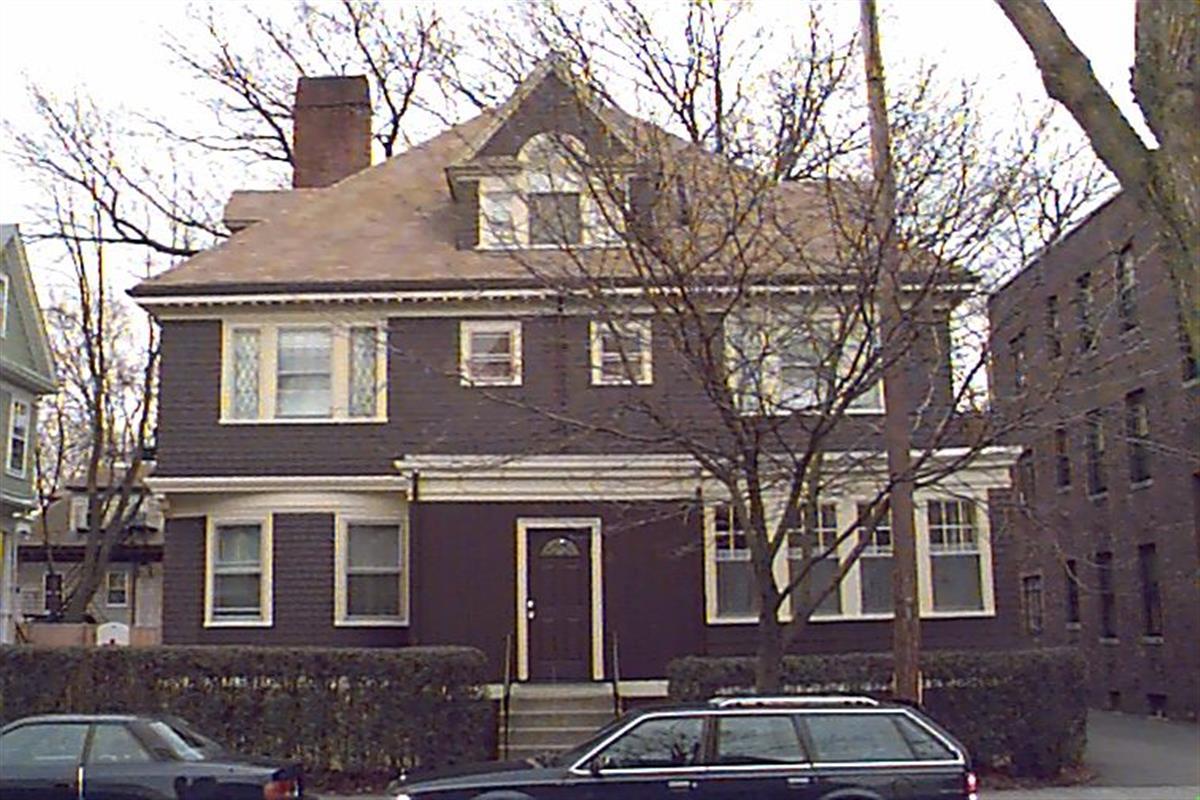
11 Naples Rd
Built:
1900Class:
Two-Family HouseLand area:
4,947 sfFAR:
0.61Owner:
Christopher Slomiak; Ming Chou & Jackson C Slomiak TrsFY26:
$1,993,900 Δ0.27%| FY | Assessed | Change |
| 26 | $1,993,900 | 0.27% |
| 25 | $1,988,600 | 1.29% |
| 24 | $1,963,200 | 1.32% |
| 23 | $1,937,600 | 5.01% |
| 22 | $1,845,200 | 4.00% |
| 21 | $1,774,300 | 3.67% |
| 20 | $1,711,500 | 5.00% |
| 19 | $1,630,000 | 11.23% |
| 18 | $1,465,400 | 7.81% |
| 17 | $1,359,200 | 10.00% |
| 16 | $1,235,600 | 10.00% |
| 15 | $1,123,300 | 15.45% |
| 14 | $973,000 | 5.00% |
| 13 | $926,700 | 0.00% |
| 12 | $926,700 | 0.76% |
| 11 | $919,700 | 0.00% |
| 10 | $919,700 | 0.00% |
| 09 | $919,700 | 2.44% |
| 08 | $897,800 | -2.00% |
| 07 | $916,100 | 0.00% |
| 06 | $916,100 | 17.75% |
| 05 | $778,000 | 7.02% |
| 04 | $727,000 | 9.98% |
| 03 | $661,000 | 11.41% |
| 02 | $593,300 |
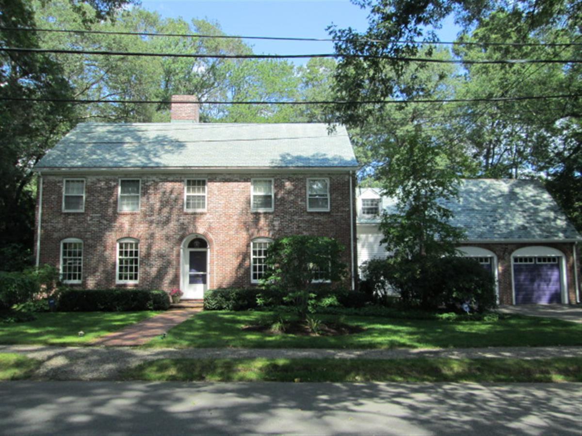
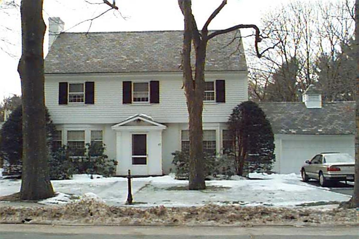
7 Cedar Rd
Built:
1941Class:
Single Family HouseLand area:
21,053 sfFAR:
0.15Owner:
Andres D & Maria J MogollonFY26:
$2,621,900 Δ4.37%| FY | Assessed | Change |
| 26 | $2,621,900 | 4.37% |
| 25 | $2,512,100 | 3.82% |
| 24 | $2,419,700 | 11.79% |
| 23 | $2,164,600 | 5.01% |
| 22 | $2,061,400 | -5.38% |
| 21 | $2,178,500 | 5.45% |
| 20 | $2,065,900 | 5.00% |
| 19 | $1,967,500 | 1.04% |
| 18 | $1,947,300 | 6.00% |
| 17 | $1,837,100 | 10.33% |
| 16 | $1,665,100 | 10.45% |
| 15 | $1,507,600 | 2.61% |
| 14 | $1,469,200 | 4.60% |
| 13 | $1,404,600 | 0.00% |
| 12 | $1,404,600 | 7.18% |
| 11 | $1,310,500 | 12.15% |
| 10 | $1,168,500 | 1.22% |
| 09 | $1,154,400 | -9.78% |
| 08 | $1,279,600 | -4.00% |
| 07 | $1,332,900 | 0.02% |
| 06 | $1,332,700 | 7.03% |
| 05 | $1,245,200 | 7.00% |
| 04 | $1,163,700 | 9.99% |
| 03 | $1,058,000 | 17.58% |
| 02 | $899,800 |
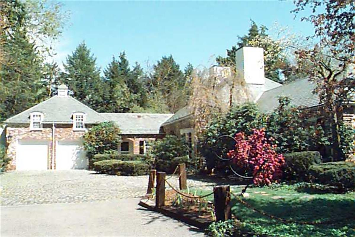
Neighborhood:
WoodlandStyle(s):
Colonial RevivalUse(s):
Single Family Dwelling HouseSignificance(s):
ArchitectureDemolition delayed to:
2027-04-07partial demolition, National Register district
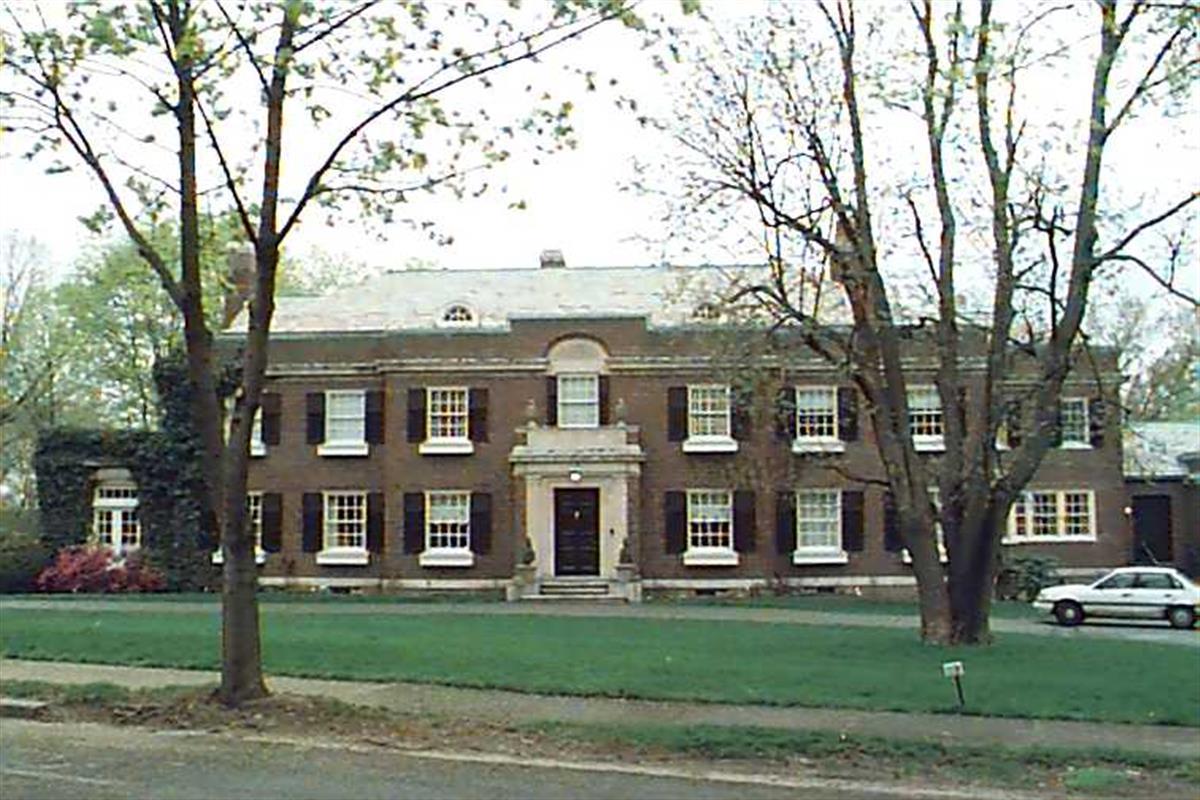
119 Hyslop Rd
Built:
1920Class:
Single Family HouseLand area:
51,748 sfFAR:
0.20Owner:
Paul B & Sandra M EdgerleyFY26:
$11,516,200 Δ-0.69%| FY | Assessed | Change |
| 26 | $11,516,200 | -0.69% |
| 25 | $11,596,200 | 2.89% |
| 24 | $11,270,000 | 13.35% |
| 23 | $9,943,000 | 5.00% |
| 22 | $9,469,600 | 4.00% |
| 21 | $9,105,400 | 3.48% |
| 20 | $8,799,600 | 5.00% |
| 19 | $8,380,600 | 3.11% |
| 18 | $8,127,600 | 6.00% |
| 17 | $7,667,400 | 7.77% |
| 16 | $7,114,600 | 7.00% |
| 15 | $6,649,200 | 2.60% |
| 14 | $6,480,900 | 3.00% |
| 13 | $6,292,100 | 0.00% |
| 12 | $6,292,100 | 4.12% |
| 11 | $6,043,300 | 0.00% |
| 10 | $6,043,300 | 0.06% |
| 09 | $6,039,600 | 3.64% |
| 08 | $5,827,500 | 0.48% |
| 07 | $5,799,600 | 0.05% |
| 06 | $5,796,500 | 22.25% |
| 05 | $4,741,700 | 7.00% |
| 04 | $4,431,500 | 11.31% |
| 03 | $3,981,400 | 35.61% |
| 02 | $2,936,000 |
Historic name:
Hammon, E. C. HouseNeighborhood:
Fisher HillArchitect(s):
Parker, Thomas and RiceStyle(s):
Colonial RevivalUse(s):
Single Family Dwelling HouseSignificance(s):
ArchitectureDesignation(s):
Nat'l Register District (10/17/1985); Nat'l Register MRA (10/17/1985)Demolition allowed:
2025-08-19partial demolition, National Register area
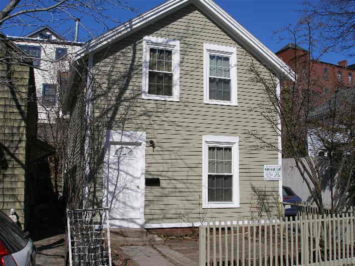
27 White Pl
Built:
1857Class:
Single Family HouseLand area:
2,050 sfFAR:
0.52Owner:
Melody K Morris; Jonathan M GreinerFY26:
$1,421,000 Δ3.09%| FY | Assessed | Change |
| 26 | $1,421,000 | 3.09% |
| 25 | $1,378,400 | 4.64% |
| 24 | $1,317,300 | 19.49% |
| 23 | $1,102,400 | 5.01% |
| 22 | $1,049,800 | 4.00% |
| 21 | $1,009,400 | 7.74% |
| 20 | $936,900 | 5.00% |
| 19 | $892,300 | 8.59% |
| 18 | $821,700 | 6.00% |
| 17 | $775,200 | 7.00% |
| 16 | $724,500 | 7.00% |
| 15 | $677,100 | 5.62% |
| 14 | $641,100 | 21.74% |
| 13 | $526,600 | 0.00% |
| 12 | $526,600 | 1.37% |
| 11 | $519,500 | 0.00% |
| 10 | $519,500 | 0.00% |
| 09 | $519,500 | 14.03% |
| 08 | $455,600 | -4.00% |
| 07 | $474,600 | 0.02% |
| 06 | $474,500 | 24.64% |
| 05 | $380,700 | 7.00% |
| 04 | $355,800 | 9.98% |
| 03 | $323,500 | 23.43% |
| 02 | $262,100 |
Historic name:
Libbey, J. O. HouseNeighborhood:
Brookline Village; White PlaceStyle(s):
Not researchedUse(s):
Single Family Dwelling HouseSignificance(s):
ArchitectureDesignation(s):
Nat'l Register District (10/17/1985); Nat'l Register MRA (10/17/1985)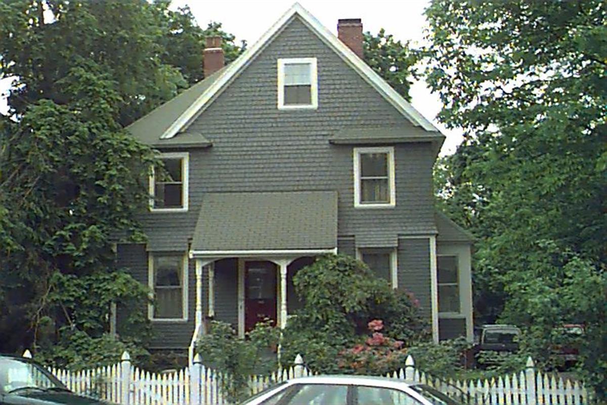
80 Greenough St
Built:
1880Class:
Single Family HouseLand area:
6,447 sfFAR:
0.41Owner:
Andreas Rolfs Trs; Dongmei ZuoFY26:
$2,218,400 Δ0.90%| FY | Assessed | Change |
| 26 | $2,218,400 | 0.90% |
| 25 | $2,198,600 | 4.01% |
| 24 | $2,113,900 | 13.85% |
| 23 | $1,856,800 | 5.00% |
| 22 | $1,768,400 | 4.01% |
| 21 | $1,700,300 | 5.73% |
| 20 | $1,608,100 | 5.00% |
| 19 | $1,531,500 | 5.46% |
| 18 | $1,452,200 | 6.99% |
| 17 | $1,357,300 | 7.00% |
| 16 | $1,268,500 | 7.00% |
| 15 | $1,185,500 | 5.76% |
| 14 | $1,120,900 | 3.00% |
| 13 | $1,088,300 | 0.00% |
| 12 | $1,088,300 | 1.10% |
| 11 | $1,076,500 | 0.00% |
| 10 | $1,076,500 | -0.33% |
| 09 | $1,080,100 | 5.13% |
| 08 | $1,027,400 | -4.24% |
| 07 | $1,072,900 | 0.90% |
| 06 | $1,063,300 | 19.34% |
| 05 | $891,000 | 7.00% |
| 04 | $832,700 | 10.00% |
| 03 | $757,000 | 13.02% |
| 02 | $669,800 |
45 Beverly Rd
Built:
1941Class:
Single Family HouseLand area:
19,200 sfFAR:
0.12Owner:
Frank Huang; Kara LingFY26:
$1,752,900 Δ8.27%| FY | Assessed | Change |
| 26 | $1,752,900 | 8.27% |
| 25 | $1,619,000 | 3.92% |
| 24 | $1,557,900 | 11.29% |
| 23 | $1,399,900 | 5.00% |
| 22 | $1,333,200 | 4.00% |
| 21 | $1,281,900 | 6.18% |
| 20 | $1,207,300 | 5.00% |
| 19 | $1,149,800 | 0.08% |
| 18 | $1,148,900 | 6.00% |
| 17 | $1,083,900 | 7.00% |
| 16 | $1,013,000 | 7.00% |
| 15 | $946,700 | 7.71% |
| 14 | $878,900 | 3.00% |
| 13 | $853,300 | 0.00% |
| 12 | $853,300 | -1.85% |
| 11 | $869,400 | 0.00% |
| 10 | $869,400 | -1.52% |
| 09 | $882,800 | 2.71% |
| 08 | $859,500 | -3.74% |
| 07 | $892,900 | -0.30% |
| 06 | $895,600 | 12.23% |
| 05 | $798,000 | 7.00% |
| 04 | $745,800 | 10.02% |
| 03 | $677,900 | 10.37% |
| 02 | $614,200 |
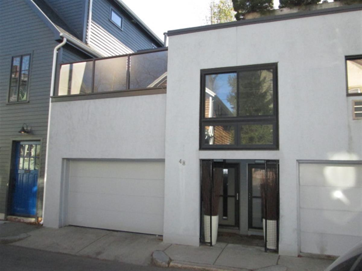
48-54 White Pl
Built:
c1860Units:
6Class:
Residential CondominiumFY26:
$5,035,300 Δ1.51%Repeat search and uncheck condominium consolidation to view info by unit.
| FY | Assessed | Change |
| 26 | $5,035,300 | 1.51% |
| 25 | $4,960,300 | 2.00% |
| 24 | $4,863,200 | 1.63% |
| 23 | $4,785,400 | 2.00% |
| 22 | $4,691,500 | 0.99% |
| 21 | $4,645,300 | 1.00% |
| 20 | $4,599,400 | 6.51% |
| 19 | $4,318,300 | 2.70% |
| 18 | $4,204,700 | 8.62% |
| 17 | $3,871,100 | 12.10% |
| 16 | $3,453,400 | 10.53% |
| 15 | $3,124,500 | 9.54% |
| 14 | $2,852,400 | 4.99% |
| 13 | $2,716,800 | 0.00% |
| 12 | $2,716,800 | -2.22% |
| 11 | $2,778,400 | 0.00% |
| 10 | $2,778,400 | 0.54% |
| 09 | $2,763,600 | 3.15% |
| 08 | $2,679,100 | -2.92% |
| 07 | $2,759,700 | 3.00% |
| 06 | $2,679,200 | 14.86% |
| 05 | $2,332,500 | 8.34% |
| 04 | $2,152,900 | -0.75% |
| 03 | $2,169,100 | 37.48% |
| 02 | $1,577,700 |
Historic name:
Seamans, J. M. HouseNeighborhood:
Brookline Village; White PlaceStyle(s):
Not researchedUse(s):
Single Family Dwelling HouseSignificance(s):
ArchitectureDesignation(s):
Nat'l Register District (10/17/1985); Nat'l Register MRA (10/17/1985)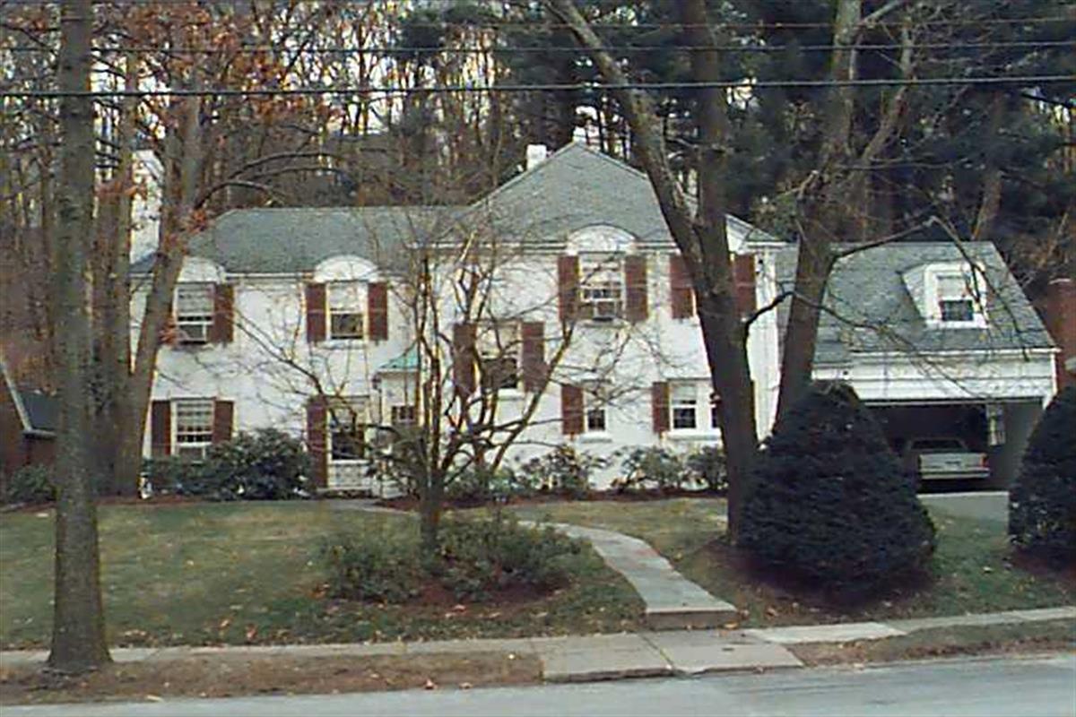
52 Beverly Rd
Built:
1935Class:
Single Family HouseLand area:
15,890 sfFAR:
0.19Owner:
Elizabeth H & Oliver C Jr Scholle TrsFY26:
$2,158,600 Δ6.63%| FY | Assessed | Change |
| 26 | $2,158,600 | 6.63% |
| 25 | $2,024,400 | 3.97% |
| 24 | $1,947,100 | 10.71% |
| 23 | $1,758,800 | 5.00% |
| 22 | $1,675,100 | 59.20% |
| 21 | $1,052,200 | -19.41% |
| 20 | $1,305,600 | 5.00% |
| 19 | $1,243,400 | 0.93% |
| 18 | $1,232,000 | 6.00% |
| 17 | $1,162,300 | 7.00% |
| 16 | $1,086,300 | 7.00% |
| 15 | $1,015,200 | 7.19% |
| 14 | $947,100 | 3.00% |
| 13 | $919,500 | 0.00% |
| 12 | $919,500 | 0.77% |
| 11 | $912,500 | 0.00% |
| 10 | $912,500 | 0.00% |
| 09 | $912,500 | -1.18% |
| 08 | $923,400 | -4.35% |
| 07 | $965,400 | -0.01% |
| 06 | $965,500 | 9.98% |
| 05 | $877,900 | 7.00% |
| 04 | $820,500 | 10.00% |
| 03 | $745,900 | 7.79% |
| 02 | $692,000 |
25 Fisher Ave
Built:
1950Class:
Single Family HouseLand area:
41,289 sfFAR:
0.10Owner:
John M Keough; Andrea DowFY26:
$5,048,400 Δ6.08%| FY | Assessed | Change |
| 26 | $5,048,400 | 6.08% |
| 25 | $4,758,900 | 4.08% |
| 24 | $4,572,300 | 24.05% |
| 23 | $3,686,000 | 5.00% |
| 22 | $3,510,400 | 4.00% |
| 21 | $3,375,400 | 7.35% |
| 20 | $3,144,300 | 5.00% |
| 19 | $2,994,600 | -4.71% |
| 18 | $3,142,500 | 6.59% |
| 17 | $2,948,100 | 7.00% |
| 16 | $2,755,300 | 7.00% |
| 15 | $2,575,000 | 11.14% |
| 14 | $2,316,800 | 3.00% |
| 13 | $2,249,300 | 0.00% |
| 12 | $2,249,300 | 6.65% |
| 11 | $2,109,100 | 0.00% |
| 10 | $2,109,100 | 0.20% |
| 09 | $2,104,900 | 2.40% |
| 08 | $2,055,600 | -5.52% |
| 07 | $2,175,600 | 0.01% |
| 06 | $2,175,400 | 13.41% |
| 05 | $1,918,200 |
Historic name:
Price, Daniel E. HouseNeighborhood:
Fisher HillArchitect(s):
Wills, Royal BarryStyle(s):
Postwar TraditionalUse(s):
Single Family Dwelling HouseSignificance(s):
ArchitectureDesignation(s):
Nat'l Register District (10/17/1985); Nat'l Register MRA (10/17/1985)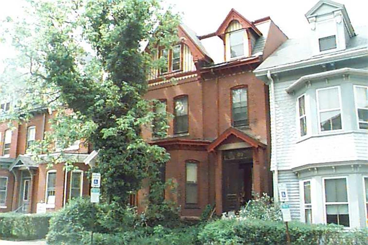
129 Walnut St
Built:
c1879Class:
Single Family HouseLand area:
2,011 sfFAR:
1.41Owner:
129 Walnut Street LLCFY26:
$892,500 Δ8.74%| FY | Assessed | Change |
| 26 | $892,500 | 8.74% |
| 25 | $820,800 | 4.27% |
| 24 | $787,200 | 12.23% |
| 23 | $701,400 | 5.00% |
| 22 | $668,000 | 4.00% |
| 21 | $642,300 | 8.72% |
| 20 | $590,800 | 4.99% |
| 19 | $562,700 | 16.14% |
| 18 | $484,500 | 6.02% |
| 17 | $457,000 | 7.00% |
| 16 | $427,100 | 6.99% |
| 15 | $399,200 | -2.20% |
| 14 | $408,200 | 3.00% |
| 13 | $396,300 | 0.00% |
| 12 | $396,300 | 3.18% |
| 11 | $384,100 | 0.00% |
| 10 | $384,100 | -0.08% |
| 09 | $384,400 | -7.93% |
| 08 | $417,500 | -4.00% |
| 07 | $434,900 | 0.00% |
| 06 | $434,900 | -4.75% |
| 05 | $456,600 | 6.98% |
| 04 | $426,800 | 11.64% |
| 03 | $382,300 | -19.57% |
| 02 | $475,300 |
Neighborhood:
Pill HillStyle(s):
Not researchedUse(s):
Multiple Family Dwelling HouseSignificance(s):
ArchitectureDesignation(s):
Local Historic District (9/6/1983)